

- Usage in publication:
-
- Fine Gold Intrusive Suite*
- Modifications:
-
- Named
- Dominant lithology:
-
- Granite
- Granodiorite
- Tonalite
- AAPG geologic province:
-
- Sierra Nevada province
Summary:
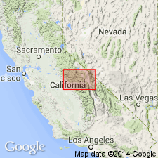
Named for exposures along Fine Gold Creek. Type area is Ward Mountain-Bass Lake area, central Sierra Nevada, CA [approx 37 to 38 deg N, 119 deg 15' to 120 deg W]. Previously called Fine Gold granitoid sequence by Stern and others (1981). Consists of tonalite of Ross Creek; Bass Lake Tonalite (New) which includes Poopenaut Valley, Hazel Green and Indian Flat plutons; granites of Hogan, Goat, and Thornberry Mountains; granodiorites of Arch Rock, Sawmill Mountain, and Crane Flat; Ward Mountain Trondhjemite; and Knowles Granodiorite which includes granodiorite southwest of Rabbit Hill and trondhjemite north of Eastman Lake. Characterized by low contents of K and alkali feldspar. Is Early Cretaceous based on isotopic ages of included units.
Source: GNU records (USGS DDS-6; Menlo GNULEX).
For more information, please contact Nancy Stamm, Geologic Names Committee Secretary.
Asterisk (*) indicates published by U.S. Geological Survey authors.
"No current usage" (†) implies that a name has been abandoned or has fallen into disuse. Former usage and, if known, replacement name given in parentheses ( ).
Slash (/) indicates name conflicts with nomenclatural guidelines (CSN, 1933; ACSN, 1961, 1970; NACSN, 1983, 2005, 2021). May be explained within brackets ([ ]).