

- Usage in publication:
-
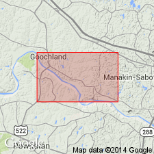
- Fine Creek Mills Granite
- Modifications:
-
- Named
- Dominant lithology:
-
- Granite
- AAPG geologic province:
-
- Piedmont-Blue Ridge province
Summary:
Fine Creek Mills Granite named in Powhatan Co., east-central VA. Unit is a two-feldspar biotite granite with foliation and flow-banding. Intrudes State Farm Gneiss in core of north-northeast-trending antiform. Age is late Paleozoic(?).
Source: GNU records (USGS DDS-6; Reston GNULEX).

- Usage in publication:
-
- Fine Creek Mills granite
- Modifications:
-
- Overview
- AAPG geologic province:
-
- Piedmont-Blue Ridge province
Summary:
Unit used informally on State map. Described in text as light-gray, medium- to coarse-grained, homogeneous, foliated, flow-banded granite. Predominant minerals are microcline, plagioclase, quartz, and biotite. Accessories include apatite, garnet, fluorite, and zircon. Intrudes State Farm Gneiss.
Source: GNU records (USGS DDS-6; Reston GNULEX).
For more information, please contact Nancy Stamm, Geologic Names Committee Secretary.
Asterisk (*) indicates published by U.S. Geological Survey authors.
"No current usage" (†) implies that a name has been abandoned or has fallen into disuse. Former usage and, if known, replacement name given in parentheses ( ).
Slash (/) indicates name conflicts with nomenclatural guidelines (CSN, 1933; ACSN, 1961, 1970; NACSN, 1983, 2005, 2021). May be explained within brackets ([ ]).