The National Geologic Map Database is migrating to a new infrastructure. We apologize for any service disruptions during this process.
|
|---|


- Usage in publication:
-
- Fincastle conglomerate [member]
- Modifications:
-
- Overview
- Dominant lithology:
-
- Conglomerate
- AAPG geologic province:
-
- Appalachian basin
Summary:
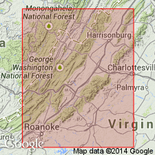
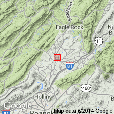
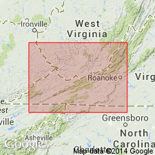
An intraformational polymictic conglomerate is recognized in the Liberty Hall formation near Fincastle, VA. This conglomerate has commonly been called the Fincastle conglomerate. [The way the Fincastle is used here, bounded below and above by the Liberty Hall formation, implies that it is a member of the Liberty Hall formation.] The conglomerate is composed of rock fragments which appear to have originated from the Unicoi formation to the New Market limestone. The predominance of limestone pebbles suggests a near-by source area.
Source: GNU records (USGS DDS-6; Reston GNULEX).
- Usage in publication:
-
- "Fincastle conglomerate"
- Modifications:
-
- Overview
- AAPG geologic province:
-
- Appalachian basin
Summary:
Author discusses the "Fincastle conglomerate" as used informally by previous workers. Consists of sandstones, sandy shales, and thick beds of coarse pebble and cobble conglomerate. The cobbles are identified to have originated from the Unicoi Formation to the Beekmantown Formation which includes 8000 to 10,000 feet of section. The "Fincastle conglomerate" occurs within the Edinburg Formation in this area of VA.
Source: GNU records (USGS DDS-6; Reston GNULEX).
- Usage in publication:
-
- Fincastle Conglomerate
- Modifications:
-
- Overview
- AAPG geologic province:
-
- Appalachian basin
Summary:
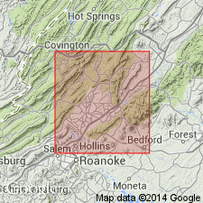
The Fincastle Conglomerate is interpreted to be a submarine fan complex on the edge of the Martinsburg flysch basin and is only found in the Pine Hills syncline in central western VA. The unit is divided into informal lower, middle, and upper members. The lower member is a channel deposit that grades upward and laterally from coarse-grained cobble conglomerate with a sandstone matrix to coarse-grained sandstone with pebble conglomerate lenses to interbedded sandstone and conglomerate sandstone to mudstone. The middle member consists of medium to dark gray conglomerate containing small cobbles and pebbles floating in an unsorted mixture of smaller clasts, sand grains and mudstone. The upper member consists of interbedded conglomeratic channel deposits and mudstone near the base and conglomeratic sandstone and mudstone toward the top. The upper contact of the Fincastle is placed at the top of the uppermost thick sandstone within the transition zone below the Martinsburg Formation. The Fincastle has gradational contacts with the underlying Paperville Shale and overlying Martinsburg Formation.
Source: GNU records (USGS DDS-6; Reston GNULEX).
- Usage in publication:
-
- Fincastle Conglomerate Member
- Modifications:
-
- Revised
- AAPG geologic province:
-
- Appalachian basin
Summary:
Revised the Fincastle to the Fincastle Conglomerate Member of the Martinsburg Formation. Unit has three dominant lithologies of conglomerate, sandstone, and shale. The Fincastle is interpreted to be a submarine fan. It is placed within the Martinsburg Formation on practical mappability. The contact with the underlying Paperville Formation can be easily mapped.
Source: GNU records (USGS DDS-6; Reston GNULEX).
- Usage in publication:
-
- Fincastle Conglomerate*
- Modifications:
-
- Overview
- AAPG geologic province:
-
- Appalachian basin
Summary:
Author follows usage of Bartholomew and others (1982) for the Fincastle Conglomerate. However, figure 3 shows the Fincastle Conglomerate Member of the Martinsburg Shale and table 1 shows the Fincastle Conglomerate Member of the Martinsburg Formation. Consists of interbedded gray shales, gray siltstones, gray to brown fine- to medium-grained litharenites, and gray to brown granule to boulder conglomerates. Conglomeratic zones range in thickness from 30 to 409 cm. Total exposed thickness is 15 to 50 meters. Eight facies were recognized (stratigraphic relationships not specified): (1) matrix-supported granule to boulder conglomerate and pebbly sandstone, (2) clast-supported granule to boulder conglomerate, (3) fine- to medium-grained sandstone, (4) laminated to bedded siltstone, (5) massive and finely laminated shale, (6) interbedded conglomerate, coarse-grained sandstone, and shale, (7) interbedded shale and sandstone, (8) gray and dusky yellow shale with convolute bedding. The environment of deposition is interpreted to be a submarine channel near the edge of the outer shelf. Changes in facies represent a combination of tectonic, climatic, and sedimentological influences.
Source: GNU records (USGS DDS-6; Reston GNULEX).
- Usage in publication:
-
- Fincastle Conglomerate
- Modifications:
-
- Overview
- AAPG geologic province:
-
- Appalachian basin
GNU Staff, 1992, GNU Staff remark.: U.S. Geological Survey Digital Data Series, DDS-6, 1 CD-ROM., release 3
Summary:
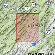
Although the term Fincastle Conglomerate has been used for many years in guidebooks, abstracts, and informally in publications, no official naming paper exists for the unit. Kellberg and Grant (1956, GSA Bull. vol. 67, p. 697-716) thoroughly discuss the unit but use it informally as the conglomerate near Fincastle, Botetourt Co., VA. Consists of polymict conglomerate containing clasts of limestone, quartzite, sandstone, and chert. Unit is 17 m thick and is of Middle Ordovician age.
Source: GNU records (USGS DDS-6; Reston GNULEX).
- Usage in publication:
-
- Fincastle Conglomerate Member
- Modifications:
-
- Overview
- AAPG geologic province:
-
- Appalachian basin
Summary:
The Fincastle Conglomerate Member of the Martinsburg Formation is interpreted as a lateral equivalent, in part, of the Mohawkian Walker Mountain Sandstone Member of the Bays, Moccasin, and Eggleston Formations, a thin, but widespread sheet deposit in western VA and TN.
Source: GNU records (USGS DDS-6; Reston GNULEX).
For more information, please contact Nancy Stamm, Geologic Names Committee Secretary.
Asterisk (*) indicates published by U.S. Geological Survey authors.
"No current usage" (†) implies that a name has been abandoned or has fallen into disuse. Former usage and, if known, replacement name given in parentheses ( ).
Slash (/) indicates name conflicts with nomenclatural guidelines (CSN, 1933; ACSN, 1961, 1970; NACSN, 1983, 2005, 2021). May be explained within brackets ([ ]).