- Usage in publication:
-
- Filer sandstone lentil*
- Modifications:
-
- Original reference
- Dominant lithology:
-
- Sandstone
- AAPG geologic province:
-
- Michigan basin
Summary:
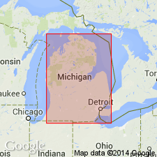
Pg. 2 (fig. 2), 7, 9, 12. Filer sandstone lentil. Lies within carbonate rock sequence above Sylvania sandstone member of Amherstburg formation and below Lucas formation. Thickness exceeds 50 feet in Bay and western Manistee Counties, and as much as 100 feet in western Michigan. Age is Middle Devonian.
Type section (subsurface): Ruggles and Rademacher well 24, sec. 12, T. 21 N., R. 17 W., Filer Twp., Manistee Co., MI. Confined for most part to western flank of Michigan basin.
Source: US geologic names lexicon (USGS Bull. 1200, p. 1347).
For more information, please contact Nancy Stamm, Geologic Names Committee Secretary.
Asterisk (*) indicates published by U.S. Geological Survey authors.
"No current usage" (†) implies that a name has been abandoned or has fallen into disuse. Former usage and, if known, replacement name given in parentheses ( ).
Slash (/) indicates name conflicts with nomenclatural guidelines (CSN, 1933; ACSN, 1961, 1970; NACSN, 1983, 2005, 2021). May be explained within brackets ([ ]).

