The National Geologic Map Database is migrating to a new infrastructure. We apologize for any service disruptions during this process.
|
|---|


- Usage in publication:
-
- Field Springs unit
- [Fields Spring unit]
- Modifications:
-
- [Informally named]
- AAPG geologic province:
-
- Eastern Columbia basin
Summary:
Pg. 23 (fig. 1), 38 (table 2), 43. Field Springs unit (informal) in Grande Ronde Basalt of Columbia River Basalt Group. Consists of 2 flows; typically aphyric. Has normal magnetic polarity (in N2 magnetostratigraphic unit). Confined to eastern part of Columbia Plateau. Lies above Winter Water unit (informal) and below Slack Canyon unit (informal); both in Grande Ronde Basalt. Age is middle Miocene.
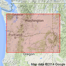
Named from exposures near Field Springs State Park, Grande Ronde Valley, southeastern WA. [Misprint (p. 43): name of park, and 7.5-min quadrangle, is Fields Spring (not Field Springs). It was named after Mr. Fields, an early settler who developed the spring for himself and his neighbors. It is located in secs. 16 and 21, T. 7 N., R. 45 E., Fields Spring 7.5-min quadrangle, Asotin Co., WA.]
Reference localities: (1) Grande Ronde Canyon rim south of Big Butte, in SW/4 SW/4 sec. 1, T. 7 N., R. 44 E., [Fields Spring 7.5-min quadrangle], WA; and (2) Marengo grade, in NE/4 sec. 12, T. 11 N., R. 40 E., Zumwalt 7.5-min quadrangle, [Columbia Co., southeastern WA].
[Additional locality and historical information from USGS GNIS database, USGS historical topographic map collection TopoView, and from Washington State Parks; accessed September 15, 2013.]
Source: Publication.
For more information, please contact Nancy Stamm, Geologic Names Committee Secretary.
Asterisk (*) indicates published by U.S. Geological Survey authors.
"No current usage" (†) implies that a name has been abandoned or has fallen into disuse. Former usage and, if known, replacement name given in parentheses ( ).
Slash (/) indicates name conflicts with nomenclatural guidelines (CSN, 1933; ACSN, 1961, 1970; NACSN, 1983, 2005, 2021). May be explained within brackets ([ ]).