The National Geologic Map Database is migrating to a new infrastructure. We apologize for any service disruptions during this process.
|
|---|


- Usage in publication:
-
- Fields Creek Formation*
- Modifications:
-
- Overview
- AAPG geologic province:
-
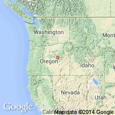
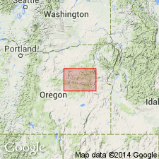
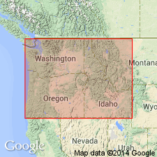
- Blue Mountains province
Summary:
Pg. A25-A26, A29 (fig. 4). Fields Creek Formation of Aldrich Mountains Group (Brown and Thayer, 1966, USGS Misc. Inv. Ser. Map I-447). Greatest known thickness is about 15,000 feet, in a section extending northeast across Fields Creek and ridge north of Fields Peak. There, lower 10,000 to 11,000 feet is dominated by beds of siliceous mudstone, mostly less than a foot thick, and black shale. In lowermost 4,000 feet, andesite flows, andesitic to dacitic volcanic breccia, lenticular rubbly conglomerate consisting mostly of reworked debris from Triassic rocks, lenses of slide breccia made up entirely of basement rocks, banded chert, and waterlaid ash are complexly intercalated. Upper part of formation includes Cinnabar Tuff Tongue (Brown and Thayer, 1966, USGS GQ-548), a massive to obscurely bedded waterlaid andesitic tuff rich in pumiceous fragments; thickness 0 to 8,500 feet. Fields Creek Formation unconformably overlies Paleozoic rocks, serptentinite, gabbro, and Vester Formation. Top of formation in places is faulted off against, in places is unconformable with, and elsewhere grades into, the Laycock Graywacke. Is believed to be no older than late Late Triassic age; fossil brachiopod HALORELLA recovered from transported blocks of reef limestone in basal shaly part of formation, near Horseshoe Butte (N.J. Silberling, written commun., 1963). Age is considered Late Triassic(?).
Source: Publication.

- Usage in publication:
-
- Fields Creek Formation*
- Modifications:
-
- Revised
- AAPG geologic province:
-
- Blue Mountains province
Summary:
Mapped in Mount Vernon 15' quad, Grant Co, OR. Siliceous mudstone, graywacke, and shale of unit is as much as 4,000 ft thick in canyon of Riley Creek. Cinnabar Tuff Tongue (new) of Fields Creek Formation is named for outcrops on Cinnabar Mountain. Tuff is 8,500 ft thick in canyon of Riley Creek. Also shown separately on map is bouldery conglomerate facies in McClellan and Ran Creeks. In places is in fault contact with overlying Laycock Graywacke. Unconformably underlies Rattlesnake Formation. Is assigned Late Triassic(?) age.
Source: GNU records (USGS DDS-6; Menlo GNULEX).
- Usage in publication:
-
- Fields Creek Formation*
- Modifications:
-
- Named
- Dominant lithology:
-
- Shale
- Mudstone
- Breccia
- Andesite
- AAPG geologic province:
-
- Blue Mountains province
Summary:
Fields Creek Formation. Formal proposal of name. Is oldest formation in Aldrich Mountains Group (new). Lower 10,000 to 11,000 feet of formation dominated by black shale and beds of siliceous mudstone, mostly less than a foot thick. In lowermost 4,000 feet, andesite flows, andesitic to dacitic breccia, lenticular rubbly conglomerate (consisting mostly of reworked debris from Triassic rocks), lenses of slide breccia (made up entirely of basement rocks), banded chert, and water-laid ash are complexly intercalated. Upper part of formation, about 3,500 feet thick, consists mostly of massive to obscurely bedded andesitic tuff rich in pumiceous fragments. Tuff thickens northeastward to about 8,500 feet and thins rapidly southeastward; locally grades upward into siliceous mudstone, shale, and graywacke. Thickness 15,000 feet at type section. Unconformably overlies Paleozoic rocks, serpentine, gabbro, and Vester Formation. Top of formation in places is faulted against, in places unconformable with, and elsewhere grades into, Laycock Graywacke (new) of Aldrich Mountains Group. Believed to be no older than late Late Triassic (N.J. Silberling, written commun, 1963). Fossil collection taken from transported blocks of reef limestone in basal shaly part of formation, near Horseshoe Butte, yielded the brachiopod HALORELLA. Age is considered Late Triassic(?). (Fields Creek Formation of Aldrich Mountains Group adopted by the USGS.)
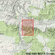
Type section designated as exposures extending northeast across Fields Creek and ridge north of Fields Creek. Named from Fields Creek, along eastern side of Aldrich Mountain quadrangle, Grant Co., OR.
Source: US geologic names lexicon (USGS Bull. 1350, p. 256); Changes in stratigraphic nomenclature, 1965 (USGS Bull. 1244-A, p. A4); supplemental information from GNU records (USGS DDS-6; Menlo GNULEX).
- Usage in publication:
-
- Fields Creek Formation*
- Modifications:
-
- Mapped
- AAPG geologic province:
-
- Blue Mountains province
Summary:
Mapped in Aldrich Mountain 15-min quadrangle, Grant County, Oregon. Consists mostly of graywacke, shale, and siliceous mudstone. Andesitic coarse-grained to shaly, water-laid tuff with mudflow breccia shown separately on map. Also shown separately are basaltic and andesitic flows and breccias and slide breccias composed mostly of pre-Upper Triassic rocks. Overlies with angular unconformity Vester Formation. Underlies with angular unconformity Rattlesnake Formation; also unconformably underlies Pleistocene alluvium. Assigned Late Triassic(?) age.
Source: GNU records (USGS DDS-6; Menlo GNULEX).
- Usage in publication:
-
- Fields Creek Formation*
- Modifications:
-
- Biostratigraphic dating
- AAPG geologic province:
-
- Blue Mountains province
Summary:
Black chert sample was collected along Field Creek road, approximately 11.3 miles south of intersection of Highway 26 and Fields Creek Road, in sec. 5, T. 14 S., R. 29 E., Aldrich Mountain 15-min quadrangle, Grant County, Oregon. Sample collected from olistrostrome-rich, basal portion of Fields Creek Formation. Contains Upper Triassic (lower Karnian to middle Norian) radiolarians.
Source: Modified from GNU records (USGS DDS-6; Menlo GNULEX).
For more information, please contact Nancy Stamm, Geologic Names Committee Secretary.
Asterisk (*) indicates published by U.S. Geological Survey authors.
"No current usage" (†) implies that a name has been abandoned or has fallen into disuse. Former usage and, if known, replacement name given in parentheses ( ).
Slash (/) indicates name conflicts with nomenclatural guidelines (CSN, 1933; ACSN, 1961, 1970; NACSN, 1983, 2005, 2021). May be explained within brackets ([ ]).