- Usage in publication:
-
- Fielding Geosol
- Modifications:
-
- Named
- Dominant lithology:
-
- Sand
- Silt
- AAPG geologic province:
-
- Great Basin province
Summary:
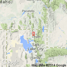
Named for the town of Fielding, UT, in Box Elder Co. Holostratotype locality includes profiles at stratigraphic sections in UT along the Bear River and Willow Creek below Cutler Dam, as follows: sec 1--lat 41 deg 42' 55" N, long 112 deg 6' 28" W, Honeyville; sec 2--lat 41 deg 46' 54" N, long 112 deg 6' 18" W, Cutler Dam; sec 5--lat 41 deg 48' 36" N, long 112 deg 4' 54" W, Cutler Dam; sec 6--lat 41 deg 48' 57" N, long 112 deg 4' 21" W, Cutler Dam; and sec 7--lat 41 deg 49' 30" N, long 112 deg 4' 36" W, Cutler Dam. Consists of traceable buried soil formed in lacustrine and marginal lacustrine deposits of the Cutler Dam Alloformation (new); "parent material" is sand and silt of the Cutler Dam. Consists of a Bk horizon having a maximum development of carbonate morphologic stage II in a typical profile. Thickness ranges from 0-135+ cm. Disconformably underlies Bonneville Alloformation; overlies Cutler Dam Alloformation. May correlate with Promontory Geosol. Schematic diagram; measured stratigraphic sections. Of late Pleistocene age. Developed between 40,000 yr B.P. and 25,000 yr B.P.; soil formation terminated by transgression of Lake Bonneville.
Source: GNU records (USGS DDS-6; Denver GNULEX).
For more information, please contact Nancy Stamm, Geologic Names Committee Secretary.
Asterisk (*) indicates published by U.S. Geological Survey authors.
"No current usage" (†) implies that a name has been abandoned or has fallen into disuse. Former usage and, if known, replacement name given in parentheses ( ).
Slash (/) indicates name conflicts with nomenclatural guidelines (CSN, 1933; ACSN, 1961, 1970; NACSN, 1983, 2005, 2021). May be explained within brackets ([ ]).

