The National Geologic Map Database is migrating to a new infrastructure. We apologize for any service disruptions during this process.
|
|---|


- Usage in publication:
-
- Fido sandstone
- Modifications:
-
- Named
- Dominant lithology:
-
- Sandstone
- AAPG geologic province:
-
- Appalachian basin
Summary:
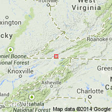
Named the Fido sandstone for Fido, Scott Co., southwestern VA. Consists of 50 feet of coarse, friable, brown to reddish sandstone. Overlies limestone equivalent in age to Gasper limestone and underlies Cove Creek limestone. Unit is probably correlative to Hardinsburg sandstone of KY. Known to extend from a point 5 miles west-southwest of Gate City to road between Lindell and Holston River in Abingdon quad. and probably extends nearly entire length of Mississippian trough southeast of Clinch Mountain. The Fido is of Mississippian age.
Source: GNU records (USGS DDS-6; Reston GNULEX).
- Usage in publication:
-
- Fido Sandstone
- Modifications:
-
- Areal extent
- AAPG geologic province:
-
- Appalachian basin
Summary:
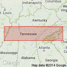
Geographically extended the Fido Sandstone into northeastern TN. Unit is a sandstone with calcareous cement and calcarenite. Contains brachiopods and trace fossils. Overlies Fisher Creek Formation and underlies Cove Creek Formation.
Source: GNU records (USGS DDS-6; Reston GNULEX).

- Usage in publication:
-
- Fido Sandstone
- Modifications:
-
- Overview
- AAPG geologic province:
-
- Appalachian basin
Summary:
The Fido Sandstone is mapped with the overlying Cove Creek Formation on the geologic map of Virginia. Consists of calcareous, reddish-brown to dark-brown, fine- to coarse-grained, thick-bedded, cross-bedded and ripple-marked, fossiliferous sandstone with one or more beds of argillaceous limestone. Thickness ranges from 35 to 75 feet. Overlies the Greenbrier Limestone.
Source: GNU records (USGS DDS-6; Reston GNULEX).
For more information, please contact Nancy Stamm, Geologic Names Committee Secretary.
Asterisk (*) indicates published by U.S. Geological Survey authors.
"No current usage" (†) implies that a name has been abandoned or has fallen into disuse. Former usage and, if known, replacement name given in parentheses ( ).
Slash (/) indicates name conflicts with nomenclatural guidelines (CSN, 1933; ACSN, 1961, 1970; NACSN, 1983, 2005, 2021). May be explained within brackets ([ ]).