The National Geologic Map Database is migrating to a new infrastructure. We apologize for any service disruptions during this process.
|
|---|


- Usage in publication:
-
- Fern Glen formation
- Modifications:
-
- Original reference
- AAPG geologic province:
-
- Illinois basin
Summary:
Pg. 438. Fern Glen formation. Red limestone, with green blotches; chert band at top and some chert scattered through it; 8.5 feet thick; containing Kinderhook fossils and underlain by 6 feet of probably softer red calcareous shale, which is not exposed but which probably belongs to Fern Glen formation and is separated from underlying Bushberg sandstone by 4 feet of hard, somewhat crystalline yellow or gray limestone. The Fern Glen is overlain by crystalline greenish gray limestone which probably belongs to Burlington limestone. Age is Early Mississippian (Kinderhook).
Source: US geologic names lexicon (USGS Bull. 896, p. 727).
- Usage in publication:
-
- Fern Glen formation
- Modifications:
-
- Principal reference
- AAPG geologic province:
-
- Illinois basin
Summary:
Pg. 265, 269, 322. Fern Glen formation. Near Fern Glen Station [Fern Glen], 20 miles west of St. Louis, [southwestern St. Louis County], central eastern Missouri, consists of (descending): (1) greenish calcareous shales with much chert, 14 feet; transition beds to overlying Burlington limestone, but contains same fauna as beds 2 and 3, below; (2) red calcareous shales, with 6-inch persistent chert band at top, 12 feet; (3) hard, red, crystalline limestone, with many crinoid stems and others fossils, 14 feet. Rests on [so-called] Choteau limestone. Included in Kinderhook. Lithologically and faunally closely resembles St. Joe marble.
Source: US geologic names lexicon (USGS Bull. 896, p. 727).

- Usage in publication:
-
- Fern Glen limestone*
- Modifications:
-
- Revised
Summary:
Pl. 29. Fern Glen limestone. Assigned Fern Glen to Osage group, and defined it as underlying Lower Burlington, as younger than Choteau limestone, and as unconformably overlying his Sulphur Springs formation.
Source: US geologic names lexicon (USGS Bull. 896, p. 727).

- Usage in publication:
-
- Fern Glen limestone*
- Modifications:
-
- Overview
Summary:
The Missouri Geol. Survey 1922 and 1926 geologic maps of Missouri assigned Fern Glen to Osage group.
Source: US geologic names lexicon (USGS Bull. 896, p. 727).
- Usage in publication:
-
- Fern Glen limestone
- Modifications:
-
- Areal extent
- AAPG geologic province:
-
- Illinois basin
Weller, Stuart, 1926, Faunal zones in the standard Mississippian section: Journal of Geology, v. 34, no. 4, p. 320-335.
Summary:
Fern Glen is a manifestation of the very lowest Burlington.
Source: US geologic names lexicon (USGS Bull. 896, p. 727).
- Usage in publication:
-
- Fern Glen limestone
- Modifications:
-
- Areal extent
- Contact revised
Summary:
Opp. p. 282. Showed Fern Glen of eastern Missouri as unconformable on Bushberg sandstone, the unconformity representing Chouteau limestone and most of underlying Hannibal shale. In 1935 (Rpt. 9th Ann. Field Conf. Kansas Geol. Soc., p. 245) Moore showed Fern Glen of Missouri and Illinois as unconformable on Glen Park formation.
Source: US geologic names lexicon (USGS Bull. 896, p. 727).
- Usage in publication:
-
- Fern Glen limestone
- Modifications:
-
- Age modified
- AAPG geologic province:
-
- Illinois basin
Summary:
Table opp. p. 30, p. 155. Fern Glen limestone of Osage group. Assigned Fern Glen to Osage group, but stated (p. 66): A consideration of all data would seem to indicate that it would not do serious violence to facts to consider the Fern Glen as earliest member of Osage division, but faunas do seem to indicate that it is older than any of typical Burlington, and if it is transferred from Kinderhook to Osage it may be necessary to transfer some portion of upper Chouteau limestone also to the Osage.
Source: US geologic names lexicon (USGS Bull. 896, p. 727).
- Usage in publication:
-
- Fern Glen limestone*
- Modifications:
-
- Overview
Summary:
The present [ca. 1938] generally accepted classification of Fern Glen assigns it to Osage group, but not to Burlington limestone.
Source: US geologic names lexicon (USGS Bull. 896, p. 727).
- Usage in publication:
-
- Fern Glen limestone
- Modifications:
-
- Areal extent
- AAPG geologic province:
-
- Illinois basin
Summary:
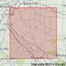
Pg. 8, pl. 1. Fern Glen limestone. Formation crops out only on Valmeyer anticline, and exposures occur from Dennis Hollow northward to SW/4 sec. 35, T. 2 S., R. 11 W. Consists chiefly of deep red more or less argillaceous limestone with interbedded shale. Thickness about 50 feet. Underlies [/]Burlington-Keokuk limestone. Age is Early Mississippian [Osage].
[The use of a hyphen between undifferentiated formations is not considered proper notation (CSN, 1933).]
Source: US geologic names lexicon (USGS Bull. 1200, p. 1339-1340).

- Usage in publication:
-
- Fern Glen limestone
- Modifications:
-
- Revised
Branson, E.B., 1944, The geology of Missouri: University of Missouri Studies, v. 19, no. 3, 535 p.
Summary:
Pg. 198-199. Fern Glen member of Chouteau formation. Interpreted as member of Chouteau formation. Age is Early Mississippian [Osage].
Source: US geologic names lexicon (USGS Bull. 1200, p. 1339-1340).
- Usage in publication:
-
- Fern Glen limestone
- Modifications:
-
- Areal extent
- Contact revised
- AAPG geologic province:
-
- Illinois basin
Summary:
Pg. 20. Fern Glen limestone. In certain parts of Ozark border area in west St. Clair and Monroe Counties, and possibly Jackson County, southwestern Illinois, Fern Glen limestone, of early Osage age, directly overlies Moccasin Springs formation (new) of the Niagaran.
Source: US geologic names lexicon (USGS Bull. 1200, p. 1339-1340).
- Usage in publication:
-
- Fern Glen limestone
- Modifications:
-
- Areal extent
- AAPG geologic province:
-
- Illinois basin
Summary:
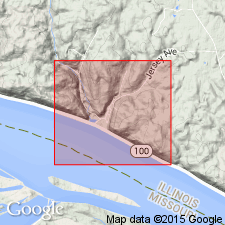
Pg. 24 (fig. 3), 50 (fig. 9), 51. Fern Glen limestone. Chautauqua, Jersey County, southwestern Illinois, is northernmost outcrop at which Fern Glen is both characteristically and well exposed. Here it has lost its distinctive red color. Shale grades upward into crinoidal limestone of Burlington; the contact is placed at point where chert nodules lose their greenish color; and the limestone becomes relatively pure. In some areas, consists of light-greenish-gray crinoidal limestone containing greenish-gray chert bands. In vicinity of Jerseyville, the Fern Glen cannot be differentiated from lower Burlington, thus indicating that it is actually a shaly facies of the Burlington. Overlies Sedalia dolomite. Valmeyer series [which includes Osage group]. Thickness about 20 feet.
Source: US geologic names lexicon (USGS Bull. 1200, p. 1339-1340).

- Usage in publication:
-
- Fern Glen Formation
- Modifications:
-
- Overview
- AAPG geologic province:
-
- Illinois basin
Summary:
Fern Glen Formation occurs in western IL from Randolph Co. north to Jersey Co. in a belt extending northeast to southwestern Champaign Co. Typically exposed in Chautauqua West Section, southern Jersey Co. Also well exposed near Valmeyer, Monroe Co. Consists of green and red calcareous shale and gray, green, and red limestone and dolomite that is partly argillaceous. Lower part generally shaly and noncherty; upper part is mainly limestone containing small nodules of greenish-gray chert. Overlaps underlying Meppen Limestone to rest of truncated rocks of Maquoketa Shale Group. Grades vertically into overlying Burlington Limestone with boundary drawn at youngest red or green bed. Fossils are abundant, notably brachiopods, corals, and crinoids. More common fossils include brachiopods SPIRIFER VERNONENSIS, S. ROWLEYI, ARTHYRIS LAMELLOSA, and LEPTAENA RHOMBOIDALIS; bryozoan EVACTINOPORA SEXRADIATA; and coral CYATHAXONIA ARCUATA. Conodont BACTROGNATHUS-POLYGNATHUS COMMUNIS Zone occurs in Fern Glen Formation and lower part of Burlington Limestone.
Source: GNU records (USGS DDS-6; Reston GNULEX).

- Usage in publication:
-
- Fern Glen Formation*
- Modifications:
-
- Areal extent
- AAPG geologic province:
-
- Illinois basin
- Ozark uplift
Summary:
Fern Glen mapped undivided with Burlington and Keokuk Limestones in St. Louis area of MO. In contrast to most stratigraphic units in the region, it thickens away from Illinois basin.
Source: GNU records (USGS DDS-6; Reston GNULEX).
For more information, please contact Nancy Stamm, Geologic Names Committee Secretary.
Asterisk (*) indicates published by U.S. Geological Survey authors.
"No current usage" (†) implies that a name has been abandoned or has fallen into disuse. Former usage and, if known, replacement name given in parentheses ( ).
Slash (/) indicates name conflicts with nomenclatural guidelines (CSN, 1933; ACSN, 1961, 1970; NACSN, 1983, 2005, 2021). May be explained within brackets ([ ]).