

- Usage in publication:
-
- Ferguson sandstone lentil
- Modifications:
-
- Overview
- Dominant lithology:
-
- Sandstone
- AAPG geologic province:
-
- Powder River basin
Summary:
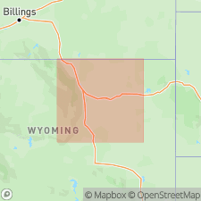
Was a local [informal] name applied to a producing sandstone in the Barber Creek and Dead Horse Creek oil fields. Origin of name Ferguson not stated. Called a lentil in the Pumpkin Buttes member (named in this report). [Also called Pumpkin Buttes?. Term lentil should not be applied to a unit that is part of a member.] Consists of a basal dark-gray, micaceous, pyritic shale, 10 ft thick, in the Tennessee Gas Transmission No. 1 USA-Jones well, in sec 15, T50N, R76W. Occurs within the Pumpkin Buttes within quotes.
Source: GNU records (USGS DDS-6; Denver GNULEX).
For more information, please contact Nancy Stamm, Geologic Names Committee Secretary.
Asterisk (*) indicates published by U.S. Geological Survey authors.
"No current usage" (†) implies that a name has been abandoned or has fallen into disuse. Former usage and, if known, replacement name given in parentheses ( ).
Slash (/) indicates name conflicts with nomenclatural guidelines (CSN, 1933; ACSN, 1961, 1970; NACSN, 1983, 2005, 2021). May be explained within brackets ([ ]).