The National Geologic Map Database is migrating to a new infrastructure. We apologize for any service disruptions during this process.
|
|---|


- Usage in publication:
-
- Ferguson Mountain formation
- Modifications:
-
- Named
- Dominant lithology:
-
- Limestone
- Sandstone
- AAPG geologic province:
-
- Great Basin province
Summary:
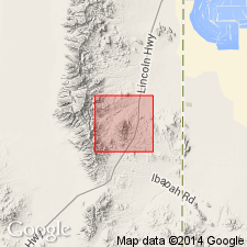
Name applied to a thick carbonate sequence above the Ely limestone and beneath Pequop formation. Was called Ferguson Spring formation by Steele (1959) in an unpublished thesis, his unit did not have a good type locality the lower part of his unit is reassigned to Ely (or Strathearn equivalent) in this paper. Mapped (geologic map) in the central part of the Ferguson Mountains from T29 to 30N, R69E, Elko Co., NV in the Great Basin province. Type section designated in secs. 21 and 22, T30N, R69E. Measured section shown graphically. Predominantly dark gray limestone, both chemical and bioclastic with some calcareous sandstone and orthoquartzite. The beds of resistant, thin- to massive-bedded limestone form cliffs 10 to 90 ft thick. The platy limestone forms slopes. Some brown to black nodular chert. Thought to be early Wolfcampian at base and early Leonardian at top. Fossils (listed): corals, fusulinoids, bryozoans, algae. Some bioherms. Is 1,985 + ft thick north of Ferguson Mountain formation is covered with Tertiary and Quaternary rocks. Of shallow marine to open marine, possibly part of a restricted basin or bank. Cyclic deposit. Correlation chart. History of nomenclature chart.
Source: GNU records (USGS DDS-6; Denver GNULEX).
- Usage in publication:
-
- Ferguson Mountain Formation
- Modifications:
-
- Revised
- AAPG geologic province:
-
- Great Basin province
Summary:
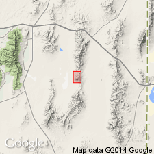
Lower contact of Ferguson Mountain Formation revised in the central Pequop Mountains in that Ferguson Mountain overlies the newly named Hogan Formation of middle and late Desmoinesian age. Is 250 ft thick in central Pequop, Elko Co., NV, Great Basin province. Underlies Pequop Formation. Fusulinids collected from highest bed in formation are late Wolfcampian age. Mapped (geologic map) in east part of map area. Graphic section.
Source: GNU records (USGS DDS-6; Denver GNULEX).
For more information, please contact Nancy Stamm, Geologic Names Committee Secretary.
Asterisk (*) indicates published by U.S. Geological Survey authors.
"No current usage" (†) implies that a name has been abandoned or has fallen into disuse. Former usage and, if known, replacement name given in parentheses ( ).
Slash (/) indicates name conflicts with nomenclatural guidelines (CSN, 1933; ACSN, 1961, 1970; NACSN, 1983, 2005, 2021). May be explained within brackets ([ ]).