

- Usage in publication:
-
- Ferguson Hill Member
- Modifications:
-
- Named
- Biostratigraphic dating
- AAPG geologic province:
-
- Great Basin province
Summary:
Unit is named the Ferguson Hill Member of the Sunrise Formation (revised) of the Volcano Peak Group (new) in the Gabbs Valley Range in west-central Nevada. Equivalent to units 5 and 6 of Muller and Ferguson (1939, GSA Bull., v. 50, no. 10, p. 1573-1624). Includes three lithologies: (1) a lower silty limestone unit consisting of 5 m of black to gray thin- to medium-bedded, silty to sandy limestone and siltstone; (2) a cherty limestone unit consisting of 35 m of brown, bluish-gray, or gray medium- to thick-bedded chert-rich limestone; and (3) an upper oolitic limestone unit consisting of 15 m of gray or orange-brown oolitic limestone and siltstone. Conformably overlies the Muller Canyon Member (new) of the Gabbs Formation of the Volcano Peak Group; conformably underlies the Five Card Draw Member (new) of the Sunrise Formation. Age is Early Jurassic (Hettangian and Sinemurian), based on fossils.
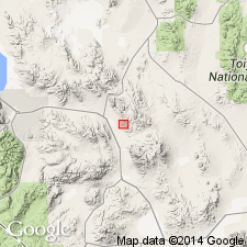
Type locality: exposures on the east flank of Ferguson Hill, west side of Muller Canyon, Gabbs Valley Range, Mineral Co., NV. This section is proposed as the stratotype for the Triassic-Jurassic System boundary.
Source: US geologic names lexicon (USGS Bull. 1565, p. 106); GNU records (USGS DDS-6; Menlo GNULEX).
For more information, please contact Nancy Stamm, Geologic Names Committee Secretary.
Asterisk (*) indicates published by U.S. Geological Survey authors.
"No current usage" (†) implies that a name has been abandoned or has fallen into disuse. Former usage and, if known, replacement name given in parentheses ( ).
Slash (/) indicates name conflicts with nomenclatural guidelines (CSN, 1933; ACSN, 1961, 1970; NACSN, 1983, 2005, 2021). May be explained within brackets ([ ]).