

- Usage in publication:
-
- Fees Rhyolite Member*
- Modifications:
-
- Named
- Dominant lithology:
-
- Rhyolite
- AAPG geologic province:
-
- Appalachian basin
Summary:
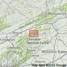
Named as a member near base of Mount Rogers Formation. Named for Fees Ridge, northeast part of Park quad, southwestern VA. Consists of highly sheared porphyritic rhyolite, characterized by a phenocryst assemblage of quartz, perthite, and plagioclase. Groundmass is aphanitic and has grayish-purple or maroon tinge. Thickness is about 100 m. Mapping of float indicates that Fees is in contact with Middle Proterozoic Cranberry Gneiss; elsewhere, Fees is in contact with lower part of Mount Rogers. Age is Late Proterozoic. Report contains geologic map.
Source: GNU records (USGS DDS-6; Reston GNULEX).
For more information, please contact Nancy Stamm, Geologic Names Committee Secretary.
Asterisk (*) indicates published by U.S. Geological Survey authors.
"No current usage" (†) implies that a name has been abandoned or has fallen into disuse. Former usage and, if known, replacement name given in parentheses ( ).
Slash (/) indicates name conflicts with nomenclatural guidelines (CSN, 1933; ACSN, 1961, 1970; NACSN, 1983, 2005, 2021). May be explained within brackets ([ ]).