

- Usage in publication:
-
- Faywood rhyolite
- Modifications:
-
- First used
- Dominant lithology:
-
- Rhyolite
- AAPG geologic province:
-
- Basin-and-Range province
Summary:
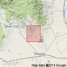
First? published use of name. Intent to name and selection of a type locality not stated. Occurs as two dome-like plugs of cream-colored, fine grained, flow layered rhyolite -one on Mimbres Mountain in secs. 17, 18, 19, 26, T 20 S, R 10 W, Luna Co., NM, and one near Faywood Hot Springs in secs 15, 16, 22, T 20 S, R 11 W, Luna Co. Both occurrences mapped (geologic map) in the Basin-and -Range province. Formations intruded by Faywood are also domed. Both plugs intrude Rubio Peak flows and Sugarlump tuff. Tertiary age assigned. Is one (of nine) units assigned to the "Lower volcanic series."
Source: GNU records (USGS DDS-6; Denver GNULEX).
For more information, please contact Nancy Stamm, Geologic Names Committee Secretary.
Asterisk (*) indicates published by U.S. Geological Survey authors.
"No current usage" (†) implies that a name has been abandoned or has fallen into disuse. Former usage and, if known, replacement name given in parentheses ( ).
Slash (/) indicates name conflicts with nomenclatural guidelines (CSN, 1933; ACSN, 1961, 1970; NACSN, 1983, 2005, 2021). May be explained within brackets ([ ]).