The National Geologic Map Database is migrating to a new infrastructure. We apologize for any service disruptions during this process.
|
|---|


- Usage in publication:
-
- Fayetteville shale
- Modifications:
-
- Named
- Dominant lithology:
-
- Shale
- AAPG geologic province:
-
- Arkoma basin
Summary:
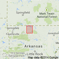
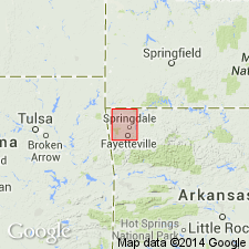
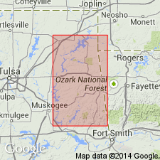
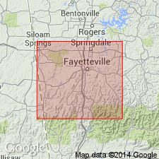
Fayetteville shale. Exposed in Washington County, Arkansas, in the Arkoma basin. Is chiefly a black shale but also may be bluish or even yellowish-brown. Has many concretions that break up into prismatic fragments. Northeast of Fayetteville is unusually rich in brachiopod remains, especially Spirifers. In southwest area of Sulphur Springs Mountain, Fayetteville forms a curious conical hill rising 150 to 175 feet above the West Fork River bottoms. Overlies Wyman sandstone (new); underlies Batesville sandstone (new). Age is Early Carboniferous. Report includes list of localities in Washington County where Fayetteville shale is exposed, geologic map of Washington County, stratigraphic table, columnar sections.
Type locality not stated. Named from its occurrence in the valleys about Fayetteville, especially those of the West Fork of White River and its tributaries.
[According to US geologic names lexicon, USGS Bull. 896, p. 725, Simonds gave the following downward succession of formations in this report: Archimedes [Pitkin] limestone; Marshall shale, 0 to 80 feet; Batesville sandstone, 10 to 60 feet; Fayetteville shale, 150 to 175 feet; Wyman sandstone, 2 to 9 feet; Boone chert and cherty limestone.]
Source: Modified from GNU records (USGS DDS-6; Denver GNULEX).
- Usage in publication:
-
- Fayetteville shale
- Modifications:
-
- Redefined
- AAPG geologic province:
-
- Arkoma basin
Summary:
Fayetteville shale. Corrected the miscorrelations made in above report [referring to F.W. Simonds, 1891, Arkansas Geol. Survey Ann. Rpt. 1888, v. 4, p. 26, 42-49], and described the following as correct stratigraphic succession (downward): Pitkin ("Archimedes") limestone; Wedington sandstone underlain by Fayetteville shale (=Marshall shale of Simonds); true Batesville sandstone (= sandstone exposed at type locality of Wyman sandstone); Moorefield shale (mistaken for Fayetteville shale by Simonds); and Boone limestone; and stated that Wedington sandstone seems to be the sandstone called Batesville by Simonds.
Source: US geologic names lexicon (USGS Bull. 896, p. 725).
- Usage in publication:
-
- Fayetteville shale
- Modifications:
-
- Revised
- AAPG geologic province:
-
- Arkoma basin
Summary:
Fayetteville shale. Treated Wedington sandstone as a member near top (in places at top) of Fayetteville shale, and this is still the approved definition. In Oklahoma this sandstone lies near middle of Fayetteville shale; in Arkansas it lies 0 to 70 feet below top of the Fayetteville.
Source: US geologic names lexicon (USGS Bull. 896, p. 725).
- Usage in publication:
-
- [Fayetteville shale]
- Modifications:
-
- Overview
- AAPG geologic province:
-
- Arkoma basin
Summary:
In Tulsa-Choteau-Grand River area, overlies Grand River limestone (new) and underlies Pitkin limestone or rocks of Morrow age. Report includes stratigraphic sections.
Source: US geologic names lexicon (USGS Bull. 1200, p. 1331).
- Usage in publication:
-
- [Fayetteville shale]
- Modifications:
-
- Areal extent
- AAPG geologic province:
-
- Arkoma basin
Branson, E.B., 1944, The geology of Missouri: University of Missouri Studies, v. 19, no. 3, 535 p.
Summary:
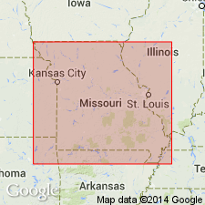
Pg. 267-268. Geographically extended into Missouri where it occurs in outliers of Boston Mountains, Reed Mountain, Lennox Mountain, and Oakleigh Mountain. Consists of black fissile carbonaceous shale and thin lenticular beds of dark-gray limestone; contains discus-shaped concretions of earthy limestone. Overlies Batesville sandstone; underlies Pennsylvanian Hale sandstone.
Source: US geologic names lexicon (USGS Bull. 1200, p. 1331).
- Usage in publication:
-
- [Fayetteville shale]
- Modifications:
-
- Overview
- AAPG geologic province:
-
- Arkoma basin
Summary:
Pg. 66-71. Described on flanks of Ozark uplift in northeastern Oklahoma. Formation is typically developed on Bragg Mountain escarpment where it is 110 feet thick. Lower 95 feet is largely black fissile shale with thin interbeds of blue-black lithographic limestone; upper part consists of interbedded limestone and shale; grades upward into overlying Pitkin through 6.5-foot zone of rubbly nodular-weathering black to gray lithographic limestone; in eastern Adair County 165 feet thick; lower 100 feet consists of black fissile shale with black lithographic septarian concretions; overlying Wedington sandstone member is as much as 25 feet thick. Unconformably overlies Hindsville limestone; where Hindsville is absent, the Fayetteville rests upon "Boone" chert knobs; where the Pitkin is missing Hale formation rests upon the Fayetteville; in northernmost exposures in Craig County, succeeded unconformably by sandstones and shales of Middle Pennsylvanian age.
Source: US geologic names lexicon (USGS Bull. 1200, p. 1331).
- Usage in publication:
-
- [Fayetteville shale]
- Modifications:
-
- Overview
- AAPG geologic province:
-
- Arkoma basin
Summary:
Pg. 55-56. Fayetteville, in area of this report [southwestern Washington County, AR], is divided into four units. Major part of formation is lower black shale member; near base of this unit is a locally developed limestone known as Mayes limestone member. Lower shale member is overlain by Wedington shale member. Upper member is light-colored silty shale. Thickness 100 to 247 feet. Underlies Pitkin formation. [Age is] Chesterian.
Source: US geologic names lexicon (USGS Bull. 1200, p. 1331).
For more information, please contact Nancy Stamm, Geologic Names Committee Secretary.
Asterisk (*) indicates published by U.S. Geological Survey authors.
"No current usage" (†) implies that a name has been abandoned or has fallen into disuse. Former usage and, if known, replacement name given in parentheses ( ).
Slash (/) indicates name conflicts with nomenclatural guidelines (CSN, 1933; ACSN, 1961, 1970; NACSN, 1983, 2005, 2021). May be explained within brackets ([ ]).