

- Usage in publication:
-
- Farson Sandstone Member*
- Modifications:
-
- Named
- Dominant lithology:
-
- Sandstone
- Shale
- Siltstone
- Conglomerate
- AAPG geologic province:
-
- Green River basin
Summary:
Named as a member of Green River Formation for Farson, WY. Type section designated and measured in sec 13, T23N, R105W, Sweetwater Co, WY, Greater Green River basin. These rocks formerly included in Tipton Shale Member of Green River by Bradley, in New Fork Tongue of Wasatch by Culbertson. Intertongues with and replaced laterally across basin by Alkali Creek Tongue (new) of Wasatch and Scheggs Bed (new) of Tipton. Overlies Scheggs and underlies Rife Bed (new) of Tipton. Consists at type of brown to gray, fine-, medium-, to very coarse grained, poorly to well sorted, subangular sandstone, and gray silty shale and shaly siltstone. Some sandstone beds conglomeratic, calcareous, shaly; some have trough crossbeds, current ripples, abundant dark grains (muscovite, biotite). Is 256.5 ft thick at type; thickest (400 ft) in Wind River Mountains; thins southward; wedges out at south part of Wind River basin. Lenses of conglomerate of gray and white chert and quartzite, gray quartz, gray-green to black schist, tan gneiss in outcrops at north. Derived from Wind River Mountains and Wyoming thrust belt. Filled Lake Gosiute. Freshwater lacustrine delta deposit. Present in northwest part of basin from south of Granger to Wind River Mountains. Identifiable in subsurface. Cross sections, areal extent maps, columnar sections. Of late early Eocene age; collections of early Eocene perissodactyls found at type and in sec 25, T25N, R102W.
Source: GNU records (USGS DDS-6; Denver GNULEX).
- Usage in publication:
-
- Farson Sandstone Member*
- Modifications:
-
- Areal extent
- Overview
- AAPG geologic province:
-
- Green River basin
Summary:
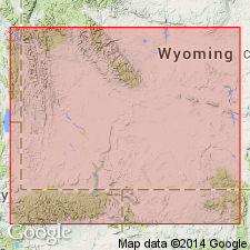
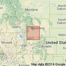
Isopach map (fig 20) shows areal extent within Greater Green River basin, WY and CO. Farson (Green River Formation) is 400 ft thick near Farson, WY, thinning to west, south, and east; not present in southern part of Green River basin. Thin remnants are present along western margins of Great Divide basin, across northern tip of Rock Springs uplift, and along part of eastern edge of Wyoming thrust belt. Stratigraphic chart; cross sections. Eocene age.
Source: GNU records (USGS DDS-6; Denver GNULEX).

- Usage in publication:
-
- Farson*
- Modifications:
-
- Overview
- AAPG geologic province:
-
- Green River basin
Summary:
Paleogeographic map (fig. 52) of this member of Green River Formation and upper part of Scheggs Bed of Tipton Shale Member of Green River and Alkali Creek Tongue of Wasatch Formation showing depositional environments in Greater Green River basin. Farson was deposited during uplift of Wind River Mountains near end of Scheggs time. Farson consists of prograding delta and shoreline sands extending nearly 100 mi southward from Wind River Mountains. Sands filled northwest part of Lake Gosiute and reduced size of lake by about 6500 sq mi (from a maximum of 15,000 sq mi during Scheggs time). Along southern and eastern edges, Farson intertongues with and is replaced by oil-shale beds in upper part of Scheggs. Along western boundary, Farson intertongues with Alkali Creek. Arkosic sediments of Battle Spring Formation continued to be deposited in northeast part of basin. Farson is in part contemporary with Alkali Creek and Scheggs; underlies Rife Bed of Tipton. Generalized stratigraphic correlation chart (ft. 41). Eocene age.
Source: GNU records (USGS DDS-6; Denver GNULEX).
For more information, please contact Nancy Stamm, Geologic Names Committee Secretary.
Asterisk (*) indicates published by U.S. Geological Survey authors.
"No current usage" (†) implies that a name has been abandoned or has fallen into disuse. Former usage and, if known, replacement name given in parentheses ( ).
Slash (/) indicates name conflicts with nomenclatural guidelines (CSN, 1933; ACSN, 1961, 1970; NACSN, 1983, 2005, 2021). May be explained within brackets ([ ]).