- Usage in publication:
-
- Farrer non-coal-bearing member*
- Modifications:
-
- Named
- Dominant lithology:
-
- Sandstone
- Coal
- AAPG geologic province:
-
- Paradox basin
Summary:
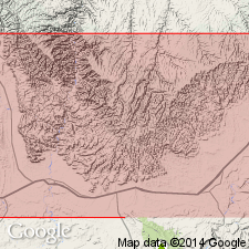
Named as a member of the Price River formation, Mesaverde group, for a coal mine in Coal Canyon, T21S, R17E, Grand Co, UT in the Paradox basin. No type locality designated. Discussed only briefly because it has no bearing on coal resources in area. Ranges from 410 to 1,095 ft thick; averages 690 ft thick. Includes thin coal lenses, cross-bedded sandstones that have a few small pebbles, and lenses of clay galls. [Not an adequate lithologic description.] Traced from Green River east into Garfield Co, CO where it is approximately equivalent to an undifferentiated part of the Mesaverde. Has freshwater shells and plants. Of Late Cretaceous age. Geologic maps.
Source: GNU records (USGS DDS-6; Denver GNULEX).
- Usage in publication:
-
- Farrer formation*
- Modifications:
-
- Revised
- AAPG geologic province:
-
- Paradox basin
Summary:
Shown on correlation chart as a unit of formation rank and the upper formation of the Mesaverde group in eastern part of Wasatch Plateau and western Book Cliffs, Emery and Grand Cos, UT in the Paradox basin. Was formerly called Farrer non-coal-bearing member of Price River formation of Mesaverde group. Of Late Cretaceous, Maestrichtian age. Correlation chart.
Source: GNU records (USGS DDS-6; Denver GNULEX).
- Usage in publication:
-
- Farrer facies
- Modifications:
-
- Revised
- AAPG geologic province:
-
- Uinta basin
- Paradox basin
Summary:
Formerly considered a member of Price River formation. Applied as an informal facies name to the non-coal-bearing rocks of the Price River formation in the western Book Cliffs area, Carbon Co (Uinta basin) and Emery Co (Paradox basin), UT. Divisible into (ascending) the Castlegate member (formerly Castlegate sandstone member) and the overlying unnamed sandstone and shale. Its eastward equivalent is the coal-bearing facies of the Price River called Neslen facies (formerly Neslen member of Price River). The contact between Farrer and Neslen facies is transitional. Cross sections. Late Cretaceous age.
Source: GNU records (USGS DDS-6; Denver GNULEX).
- Usage in publication:
-
- Farrer formation*
- Modifications:
-
- Overview
- AAPG geologic province:
-
- Paradox basin
Summary:
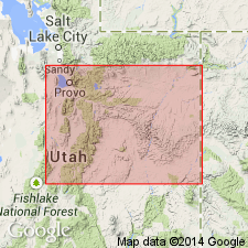
Lies above Neslen formation as a formation of the Mesaverde group. Has been traced from Green River to UT-CO state line, Paradox basin. May be equivalent to upper part of Mount Garfield formation of CO. Examined irregularly. [First published description was very generalized]. Averages 690 ft thick; ranges from 410 to 1,095 ft thick. Sandstone is cross-bedded, has "clay gall" conglomerate, and consists of subangular to poorly rounded, medium-fine quartz grains in calcareous cement. Sandstone includes 3 to 10 percent feldspar, 2-10 percent dark minerals, and a small amount of white mica. The shale is olive-green. Weathers into brown-stained blocky ledges or cliffs (sandstone) separated by shale. Seven measured sections described. Columnar sections.
Source: GNU records (USGS DDS-6; Denver GNULEX).
- Usage in publication:
-
- Farrer Formation
- Modifications:
-
- Age modified
- Overview
- AAPG geologic province:
-
- Paradox basin
- Uinta basin
Summary:
Is of late Campanian age. Palynomorphs identified in sec 10, T16S, R14E, sec 34, T15S, R14E, sec 6 and 26, T17S, R15E, Carbon Co, UT in the Uinta basin and in sec 36, T16S, R23E and in sec 15, T20S, R20E in Grand Co in Paradox basin.
Source: GNU records (USGS DDS-6; Denver GNULEX).
- Usage in publication:
-
- Farrer Formation*
- Modifications:
-
- Biostratigraphic dating
- Overview
- Dominant lithology:
-
- Sandstone
- AAPG geologic province:
-
- Paradox basin
Summary:
Palynomorph assemblage resembling Judith River Formation of MT recovered from both Tuscher and Farrer Formations along the Book Cliffs of UT, Paradox basin. No important biostratigraphic differences evident between Tuscher and Farrer. Both formations are within the AQUILAPOLLENITES QUADRILOBUS Interval Zone of Nichols and others (1982). Presence of KUYLISPORITAES SCUTATUS 10 m below the Cretaceous-Tertiary unconformity in Sego, Jim, and Bryson Canyons along the eastern Book Cliffs indicates the uppermost part of the Tuscher is no younger than middle late Campanian. In the subsurface in the Natural Buttes field where the Tuscher and Farrer are undifferentiated, the uppermost part of the sequence may be as young as early Maastrichtian. The palynomorphs ILEXOPOLLENITES COMPACTUS and MANCICORPUS STRIATUS found in that field indicate early Maastrichtian. Measured sections; correlation chart. Area studied includes the Tuscher, Sego, and Cottonwood Canyons, and Bitter Creek, Grand Co, UT. Type section designated secs 9, 13, 16, T20S, R17E; sec 1, T20S, R18E; sec 19, T19S, R19E, Tusher Canyon, Grand Co, where formation is mostly sandstone 1,400 ft thick in stacked channel-form units. Grain size decreases slightly upward. Minor amount of siltstone.
Source: GNU records (USGS DDS-6; Denver GNULEX).
- Usage in publication:
-
- Farrer Formation*
- Modifications:
-
- Age modified
- Biostratigraphic dating
Summary:
Newly defined palynostratigraphic zone MANCICORPUS STRIATUS Interval Zone is present in undifferentiated Tuscher and Farrer Formations in subsurface of Uinta Basin, UT. M. STRIATUS is assigned latest Campanian through early Maastrichtian age (73 to 69 Ma). M. STRIATUS is equivalent to interval including zones of ammonites BACULITES REESIDEI through B. CLINOLOBATUS. Tuscher and Farrer which were previously interpreted to be late Campanian or Campanian and Maastrichtian in age are now reinterpreted as early Maastrichtian in age.
Source: GNU records (USGS DDS-6; Denver GNULEX).
For more information, please contact Nancy Stamm, Geologic Names Committee Secretary.
Asterisk (*) indicates published by U.S. Geological Survey authors.
"No current usage" (†) implies that a name has been abandoned or has fallen into disuse. Former usage and, if known, replacement name given in parentheses ( ).
Slash (/) indicates name conflicts with nomenclatural guidelines (CSN, 1933; ACSN, 1961, 1970; NACSN, 1983, 2005, 2021). May be explained within brackets ([ ]).

