- Usage in publication:
-
- Farragut limestone
- Modifications:
-
- Original reference
- AAPG geologic province:
-
- Appalachian basin
Summary:
Pg. 1156-1157. Farragut limestone. Proposed for coarsely crystalline variegated limestone, or marble (of Knoxville and surrounding area) which overlies Lenoir limestone (restricted) and underlies Tellico sandstone. Thickness is 115 feet. Zone has been referred to stratigraphically as "Holston" marble in this area and represents principal zone quarried for commercial "Tennessee marble"; just east of Knoxville along Holston River, Keith (1895) assigned name "Holston" to lentils of variegated marble occurring within Chickamauga limestone; since term was originally assigned to type of lithology occurring at different horizons, term "Holston" is of no significance as definite formational unit. Age is Middle Ordovician.
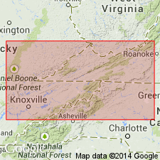
Type section: Appalachian Marble Company quarry, 1.4 mi due east of Lowes Ferry [no longer exists; Lowe Ferry, formerly on Tennessee River east of Jones Chapel, approx. Lat. 35 deg. 51 min. 10 sec. N., Long. 84 deg. 05 min. 03 sec. W., Louisville 7.5-min quadrangle (TVA 138-SE 1941 prelim. ed.), Blount Co., northeastern TN]. Named from site of Admiral "damn the torpedoes, full speed ahead" Farragut homestead at Lowes Ferry on Tennessee River, 9.5 mi southwest of Knoxville. [Additional locality information from USGS historical topographic map collection TopoView, accessed March 5, 2013.]
Source: US geologic names lexicon (USGS Bull. 1200, p. 1327).
For more information, please contact Nancy Stamm, Geologic Names Committee Secretary.
Asterisk (*) indicates published by U.S. Geological Survey authors.
"No current usage" (†) implies that a name has been abandoned or has fallen into disuse. Former usage and, if known, replacement name given in parentheses ( ).
Slash (/) indicates name conflicts with nomenclatural guidelines (CSN, 1933; ACSN, 1961, 1970; NACSN, 1983, 2005, 2021). May be explained within brackets ([ ]).

