- Usage in publication:
-
- Farmingdale Member
- Modifications:
-
- Named
- Biostratigraphic dating
- Dominant lithology:
-
- Sand
- AAPG geologic province:
-
- Atlantic Coast basin
Summary:
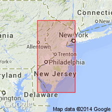
The lower member of the Manasquan Formation is here designated the Farmingdale Member for its good exposure in and near Farmingdale, Monmouth Co, NJ. [Referred to as the green marl of the upper marl bed by Cook (1868) and as the lower member of the Manasquan formation by Clark (1894).] The Farmingdale Member is in general a mottled, slightly clayey, medium to coarse, quartzose glauconitic sand. It is coarse grained, more quartzose in the lower portion and more clayey in the upper portion where it grades into the overlying Deal Member. Contact relations with the underlying Vincentown Formation wherever observed are sharp. The abrupt change to a glauconite sand from the underlying slightly glauconitic quartz sand of the Vincentown Formation is quite distinctive. Outcrop thickness of the Farmingdale Member averages about 40 ft in the northern part of the State. To the southwest, along strike as far as Medford, there is no appreciable thinning. Jordan (1962), however, does not report the unit from Delaware. Planktonic foraminiferal zonation of the Eocene sediments (Olsson, 1967, and this report) indicates that deposition of the Manasquan and overlying Shark River Formations spanned the interval from latest Paleocene to approximately middle middle Eocene.
Source: GNU records (USGS DDS-6; Reston GNULEX).
For more information, please contact Nancy Stamm, Geologic Names Committee Secretary.
Asterisk (*) indicates published by U.S. Geological Survey authors.
"No current usage" (†) implies that a name has been abandoned or has fallen into disuse. Former usage and, if known, replacement name given in parentheses ( ).
Slash (/) indicates name conflicts with nomenclatural guidelines (CSN, 1933; ACSN, 1961, 1970; NACSN, 1983, 2005, 2021). May be explained within brackets ([ ]).

