The National Geologic Map Database is migrating to a new infrastructure. We apologize for any service disruptions during this process.
|
|---|


- Usage in publication:
-
- Faraway Ranch series
- Modifications:
-
- Original reference
- Dominant lithology:
-
- Volcanics
- AAPG geologic province:
-
- Pedregosa basin
Summary:
Pg. 106 (fig. 1). Faraway Ranch series. In Rhyolite Canyon section, northern part of Chiricahua Mountains, Chircahua National Monument, Cochise County, southeastern Arizona, comprises (ascending) buff pahoehoe biotite dacite, thickness 400 feet; basalt breccia, 175 feet; lapilli tuff, 200 feet; soft white rhyolite tuff, 10 feet; and hard pink rhyolite tuff, 10 feet. Unconformably underlies Rhyolite Canyon series (new). Age is Cenozoic.
Source: US geologic names lexicon (USGS Bull. 1200, p. 1321); supplemental information from GNU records (USGS DDS-6; Denver GNULEX).
- Usage in publication:
-
- Faraway Ranch formation
- Modifications:
-
- Principal reference
- Revised
- AAPG geologic province:
-
- Pedregosa basin
Summary:
Pg. 1217, 1221 (table 2). Faraway Ranch formation. Consists of coarse rhyolite tuff and breccia, basalt breccia, and flows of biotite dacite. Thickness at least 800 feet. Unconformably overlies Bonita Park formation (new) in Hands Pass region just east of Chiricahua National Monument. Unconformably underlies Rhyolite Canyon formation. Probably correlative with Blacktail formation (new). Age is tentatively Cenozoic. Most of rhyolite deposits of Cenozoic age in Chiricahua National Monument, heretofore termed flows, are more correctly classified as welded rhyolite tuff or ignimbrite, the result of many eruptions of nuees ardentes. Origin of name given.
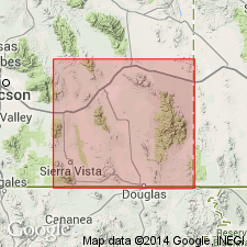
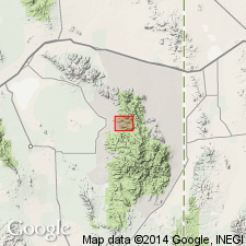
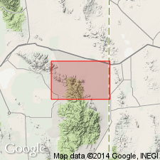
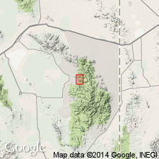
Named from outcrops near Faraway Ranch on lower Bonita Canyon, a short distance west of Chiricahua National Monument, Cochise Co., southeastern AZ.
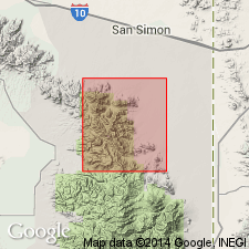
[Faraway Ranch is in SE/4 SE/4 SE/4 sec. 27, T. 16 S., R. 29 E., Lat. 32 deg. 00 min. 29 sec. N., Long. 109 deg. 22 min. 20 sec. W., Cochise Head 7.5-min quadrangle, Coronado National Forest, Cochise Co., southeastern AZ (USGS GNIS database, ACME Mapper2.0; accessed December 29, 2011).]
Source: US geologic names lexicon (USGS Bull. 1200, p. 1321); supplemental information from GNU records (USGS DDS-6; Denver GNULEX).
- Usage in publication:
-
- Faraway Ranch formation
- Modifications:
-
- Areal extent
- Age modified
- Dominant lithology:
-
- Volcanics
- Agglomerate
- AAPG geologic province:
-
- Pedregosa basin
Summary:
Pg. 1325-1327, pl. 1. Faraway Ranch formation. In Cochise Head and Vanar quadrangles, Cochise County, Arizona, all but minor part of formation consists of volcanic flows and agglomerate. Lenses of lacustrine deposits and stream-deposited tuff constitute minor part. Lacustrine deposits comprise a red clastic sequence and a light-colored sequence containing fresh-water limestone. In southeast part of the area, formation overlies Bisbee group. Age is Late Cretaceous to late Tertiary.
Source: US geologic names lexicon (USGS Bull. 1200, p. 1321).
- Usage in publication:
-
- Faraway Ranch Formation
- Modifications:
-
- Age modified
- AAPG geologic province:
-
- Pedregosa basin
Summary:
Subdivided into 9 numbered members. Described in detail. Contains several angular unconformities and disconformities. Formed during magmatic pulse in mountainous area subject to torrential rains in a semiarid climate. Is of Cenozoic (Oligocene and Miocene) age.
Source: GNU records (USGS DDS-6; Denver GNULEX).
- Usage in publication:
-
- Faraway Ranch Formation*
- Modifications:
-
- Principal reference
- Revised
- AAPG geologic province:
-
- Pedregosa basin
Summary:
Faraway Ranch Formation. Restricted to include only rhyodacitic rock, chiefly lava flows and welded ash-flow tuff, but including some intrusive masses, air-fall tuff, and tuffaceous sandstone (generally members 6 to 9 of Fernandez and Enlows, 1966). Does not include underlying andesitic rocks, although very locally an andesite flow resembling the underlying rocks may be intercalated in the rhyodacitic volcanics. At Principal reference locality consists of (ascending): basal tuffaceous sandstone and air-fall breccia, about 75 m thick; a rhyodacite flow, about 100 m thick to south (wedges out rapidly to north); and a capping unit of rhyodacitic air-fall welded tuff, at least 135 m thick. Age is considered late Oligocene, based on isotopic ages of 25.6 Ma and 25.4 Ma (Damon, [n.d.]) from overlying rocks, and 29.6 Ma and 28.7 Ma (Shafiqullah and others, 1978; R.F. Marvin and others, written commun., 1979) from underlying rocks.
Principal reference locality: high on east flank of Maverick Peak, about 3 km south of Cochise Head, in Cochise Head 7.5-min quadrangle, southeastern AZ.
Source: Publication.
For more information, please contact Nancy Stamm, Geologic Names Committee Secretary.
Asterisk (*) indicates published by U.S. Geological Survey authors.
"No current usage" (†) implies that a name has been abandoned or has fallen into disuse. Former usage and, if known, replacement name given in parentheses ( ).
Slash (/) indicates name conflicts with nomenclatural guidelines (CSN, 1933; ACSN, 1961, 1970; NACSN, 1983, 2005, 2021). May be explained within brackets ([ ]).