The National Geologic Map Database is migrating to a new infrastructure. We apologize for any service disruptions during this process.
|
|---|


- Usage in publication:
-
- Fant member
- Modifications:
-
- Original reference
- Dominant lithology:
-
- Tuff
- Clay
- AAPG geologic province:
-
- Gulf Coast basin
Summary:
Pg. 46, 65, 66-80, 178-179. Fant member of Gueydan formation. Essentially a number of beds of indurated creamy-white mudflow tuff, which commonly shows sun cracks, interstratified with friable grayish-white air-deposited tuffs and greenish-gray or purplish-pink fluviatile clays and sandy clays. Thickness 12 to 255+ feet. Basal member of Gueydan formation. Grades into overlying Soledad member of Gueydan formation, and rests on Frio formation and on Fayette formation with probable disconformity and overlap. Assigned to Oligocene, as it grades laterally into Catahoula sandstone.
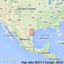
Named from numerous exposures near Fant City, northern Live Oak Co., southwestern TX coastal plain.
Source: US geologic names lexicon (USGS Bull. 896, p. 720).

- Usage in publication:
-
- Fant tuff member*
- Modifications:
-
- Overview
- AAPG geologic province:
-
- Gulf Coast basin
Summary:
Fant tuff member of Catahoula tuff. The Gueydan formation is same as Catahoula tuff, and "Gueydan" has been discarded. The formation is either Oligocene or early Miocene age. The USGS and Texas Geol. Survey (as recorded in Univ. Texas Bull., no. 3232, 1933) include Fant tuff in Catahoula, but A.C. Ellisor, 1933 (AAPG Bull., v. 17, no. 11), includes it in underlying Frio clay. Recognized in southwestern Texas Coastal Plain.
Source: US geologic names lexicon (USGS Bull. 896, p. 720).

- Usage in publication:
-
- Fant Tuff Member
- Modifications:
-
- Mapped 1:250k
- Dominant lithology:
-
- Tuff
- Claystone
- Sandstone
- AAPG geologic province:
-
- Gulf Coast basin
Summary:
Fant Tuff Member of Catahoula Formation. Tuff, claystone, and sandstone; tuff, grayish white, massively bedded, moderately well indurated, lumpy pisolitic texture; claystone, silty, pale olive, brown; sandstone, varicolored grains, in part interlaminated with pale-brown clay. Thickness about 600 feet. Is basal member of Catahoula Formation. Lies above Frio Formation (Oligocene) and below Soledad Volcanic Conglomerate Member of Catahoula. Age is Miocene.
[Mapped in Duval and McMullen Cos., southern TX.]
Source: Publication.
For more information, please contact Nancy Stamm, Geologic Names Committee Secretary.
Asterisk (*) indicates published by U.S. Geological Survey authors.
"No current usage" (†) implies that a name has been abandoned or has fallen into disuse. Former usage and, if known, replacement name given in parentheses ( ).
Slash (/) indicates name conflicts with nomenclatural guidelines (CSN, 1933; ACSN, 1961, 1970; NACSN, 1983, 2005, 2021). May be explained within brackets ([ ]).