

- Usage in publication:
-
- Falconer Formation
- Modifications:
-
- Original reference
- Dominant lithology:
-
- Clay
- Silt
- Sand
- AAPG geologic province:
-
- Sioux uplift
- Williston basin
Summary:
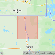
Pg. 5 (fig. 2), 17-20, 38-46 (measured sections). Falconer Formation. Light-gray (dry), soft, silty, clayey pebble-loam. In Grand Forks area (type area) contains 20 percent sand, 35 to 45 percent silt, and 35 to 45 percent clay. To north becomes more sandier and less clayey. Thickness <10 to about 100 feet; thins to the north. Overlies Wylie Formation (new) and underlies Brenna Formation (new); contacts not observed but are probably gradational. Southeast of Grand Forks, laterally grades into the Huot Formation (new). Believed to extend into southern Manitoba. [Occurs in Traill, Grand Forks, Walsh, and Pembina Counties, North Dakota, and Polk, Red Lake, Pennington, Marshall, Kittson, and Roseau Counties, Minnesota.] Deposited by readvance of a glacier into Lake Agassiz; the Edinburg moraine in Traill, Grand Forks, and Walsh Counties, North Dakota, marks limit of this glacial advance. Age is considered late Pleistocene (latest Wisconsinan); deposited about 13,500 yr B.P.
Type section (subsurface): depth-interval 84 to 123 ft, University of North Dakota-Grand Forks, Witmer Hall, Boring No. 3, in SE/4 SE/4 SE/4 sec. 5, T. 151 N., R. 50 W., Grand Forks 7.5-min quadrangle, Grand Forks Co., eastern ND.
Reference sections (subsurface), North Dakota State Water Commission (NDSWC) Testholes 2430, 2431, 2433, 2609, Grand Forks area, Grand Forks 7.5-min quadrangle, Grand Forks Co., eastern ND [localities are taken from index map (fig. 7) and measured section descriptions (p. 38-46); some differ from what is given in text]:
(1) depth-interval 74 to 118 ft, No. 2430, in NE/4 SE/4 SE/4 sec. 29, T. 152 N., R. 50 W.
(2) depth-interval 68 to 118 ft, No. 2431, in NW/4 NW/4 NW/4 sec. 22, T. 151 N., R. 50 W.
(3) depth-interval 76 to 124 ft, No. 2433, in SE/4 NE/4 SE/4 sec. 6, T. 151 N., R. 50 W.
(4) depth-interval 69 to 124 ft, No. 2609, in SE/4 SE/4 SE/4 sec. 36, T. 152 N., R. 51 W.
Named from Falconer Twp., Grand Forks area, Grand Forks 7.5-min quadrangle, Grand Forks Co., eastern ND.
Source: Publication.
For more information, please contact Nancy Stamm, Geologic Names Committee Secretary.
Asterisk (*) indicates published by U.S. Geological Survey authors.
"No current usage" (†) implies that a name has been abandoned or has fallen into disuse. Former usage and, if known, replacement name given in parentheses ( ).
Slash (/) indicates name conflicts with nomenclatural guidelines (CSN, 1933; ACSN, 1961, 1970; NACSN, 1983, 2005, 2021). May be explained within brackets ([ ]).