

- Usage in publication:
-
- Fairgrange Till Member
- Modifications:
-
- First used
- AAPG geologic province:
-
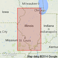
- Illinois basin
Summary:
Fairgrange Till Member (J.P. Ford, in press: Geology of Coles Co., IL) of Wedron Formation is surface till in Shelby moraine and is equivalent to Glenburn Till Member.
Source: GNU records (USGS DDS-6; Reston GNULEX).
- Usage in publication:
-
- Fairgrange Till Member
- Modifications:
-
- Overview
- AAPG geologic province:
-
- Illinois basin
Summary:
Wedron Formation in Piatt Co. consists of two till members. The lower Fairgrange Till Member is a gray-brown silty till (as mapped by Lineback, 1979) and the Piatt Till Member is a gray, sandy, silty till. The Fairgrange can be found within 20 ft of the surface.
Source: GNU records (USGS DDS-6; Reston GNULEX).
- Usage in publication:
-
- Fairgrange Till Member
- Modifications:
-
- Areal extent
- AAPG geologic province:
-
- Illinois basin
Summary:
The Fairgrange Till Member of the Wedron Formation, although absent at the Martinsville alternative site, is present in the Shelbyville Moraine 8 mi northwest of the study area. The moraine marks the maximum southward advance of the late Wisconsinan Lake Michigan Lobe about 20,000 years ago. The Fairgrange Till Member is composed chiefly of clay loam or loam diamicton and lesser amounts of sand and gravel.
Source: GNU records (USGS DDS-6; Reston GNULEX).
For more information, please contact Nancy Stamm, Geologic Names Committee Secretary.
Asterisk (*) indicates published by U.S. Geological Survey authors.
"No current usage" (†) implies that a name has been abandoned or has fallen into disuse. Former usage and, if known, replacement name given in parentheses ( ).
Slash (/) indicates name conflicts with nomenclatural guidelines (CSN, 1933; ACSN, 1961, 1970; NACSN, 1983, 2005, 2021). May be explained within brackets ([ ]).