The National Geologic Map Database is migrating to a new infrastructure. We apologize for any service disruptions during this process.
|
|---|


- Usage in publication:
-
- Fairbank formation
- Modifications:
-
- Original reference
- Dominant lithology:
-
- Sandstone
- Quartzite
- AAPG geologic province:
-
- Chadron arch
- Denver basin
Summary:
Pg. 2 (fig. 2), 3, 32, 35, 44; R.L. Bates, 1955, AAPG Bull., v. 39, no. 10, p. 1990-1991. Fairbank formation or Fairbank tongue of Fountain formation. Consists of red sandstone or quartzite which is locally calcareous. Basal tongue of Fountain formation. Comprises Division VI of Hartville "formation" (Condra and Reed, 1935). Thickness 30 to 100 feet. Underlies Reclamation group (new); overlies Pahasapa limestone. Age is Pennsylvanian.
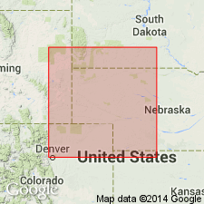
Type locality: North Platte River bluffs immediately north and northwest of site of abandoned village known as Fairbank, in sec. 27, T. 27 N., R. 66 W., Platte Co., eastern WY. [Extends into southwestern SD.]
Source: US geologic names lexicon (USGS Bull. 1200, p. 1307).
For more information, please contact Nancy Stamm, Geologic Names Committee Secretary.
Asterisk (*) indicates published by U.S. Geological Survey authors.
"No current usage" (†) implies that a name has been abandoned or has fallen into disuse. Former usage and, if known, replacement name given in parentheses ( ).
Slash (/) indicates name conflicts with nomenclatural guidelines (CSN, 1933; ACSN, 1961, 1970; NACSN, 1983, 2005, 2021). May be explained within brackets ([ ]).