

- Usage in publication:
-
- Exeter sandstone*
- Modifications:
-
- Named
- Dominant lithology:
-
- Sandstone
- AAPG geologic province:
-
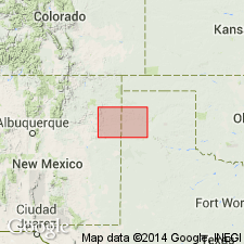
- Palo Duro basin
Summary:
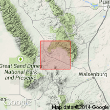
Named for Exeter post office [now abandoned] on the Rio Cimarron, Union Co, NM in Palo Duro basin. No type locality designated. Composed of firm, hard and rather coarse, evenly laminated, pink to white sandstone. Lower strata usually pink; upper strata white. Has a maximum thickness of 75 ft. Thins eastward toward State line. Extends from Exeter east to the State line. Is unfossiliferous. Is overlain conformably by shales of Morrison formation and underlain unconformably by [unnamed] red beds. No fossils found. Age not clearly stated; could be Trias; could be Early Cretaceous.
Source: GNU records (USGS DDS-6; Denver GNULEX).
- Usage in publication:
-
- Exeter sandstone
- Modifications:
-
- Contact revised
- AAPG geologic province:
-
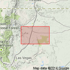
- Sierra Grande uplift
Summary:
Lower contact revised in that Exeter unconformably overlies the newly named Sheep Pen sandstone at some localities, and unconformably overlies the pre-Sheep Pen newly named Sloan Canyon formation or redbeds of Dockum group at other localities. Rocks now called Sloan Canyon were assigned to Morrison formation in earlier reports. Exeter and Sheep Pen have been considered to be the same unit in some of the earlier published reports. Name Exeter applied to the 0-80 ft thick white to pink, massive, cross-bedded sandstone. Underlies gypsum questionably assigned to the Todilto formation, or varicolored shale, limestone, sandstone, and gypsum of the Morrison formation. Stratigraphic chart. Of Jurassic? age.
Source: GNU records (USGS DDS-6; Denver GNULEX).
- Usage in publication:
-
- Exeter sandstone
- Modifications:
-
- Areal extent
- AAPG geologic province:
-
- Sierra Grande uplift
Summary:
Exeter sandstone. Varicolored, fine- to medium-grained, generally cross-bedded sandstone. Thickness as much as 80 feet. Upper contact with Morrison formation placed at base of lowest brown silt or sandstone. Rests unconformably on Dockum group (Triassic). Age is Jurassic.
Source: Modified from GNU records (USGS DDS-6; Denver GNULEX).
- Usage in publication:
-
- Exeter sandstone†
- Modifications:
-
- Abandoned
Summary:
Sandstone called Entrada sandstone in this report east of Rocky Mountains in Huerfano and Custer Cos, CO, Las Vegas-Raton basin, is believed to be equivalent to the Entrada to the west. Is also identical to rocks to south in Mora Co, NM called Ocate sandstone and to southeast along the Dry Cimarron, Union Co, NM called Exeter sandstone. Names Ocate and Exeter abandoned. Name Entrada used throughout area.
Source: GNU records (USGS DDS-6; Denver GNULEX).
- Usage in publication:
-
- Exeter Sandstone
- Modifications:
-
- Areal extent
- Overview
- Dominant lithology:
-
- Sandstone
- AAPG geologic province:
-
- Sierra Grande uplift
- Palo Duro basin
Summary:
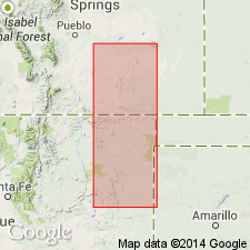
Is Upper Jurassic formation mapped in southern Harding Co, NM (Sierra Grande uplift) and in eastern San Miguel and northwest Quay Cos, NM (Palo Duro basin). Is not mapped east of Harding-Union Co line in NM. Is mapped with Morrison Formation, undivided, locally in northwest Quay Co, NM. Exeter described as sandstone--fine-grained, light-brownish-yellow to white to pale-reddish-brown; thickness 140 ft. Equivalent to Entrada Formation on New Mexico State Geologic Map.
Source: GNU records (USGS DDS-6; Denver GNULEX).

- Usage in publication:
-
- Exeter Member
- Modifications:
-
- Revised
- AAPG geologic province:
-
- Sierra Grande uplift
Summary:
Revised as a member or upper tongue of Entrada Sandstone in northeast and east-central NM on the Sierra Grande uplift. Two sandstone beds separated by a fine-grained interval were included by Lee in the type Exeter. The lower pink sandstone is designated the main body of the Entrada. The fine-grained interval is thought to represent the Todilto Formation to the west and is called Todilto Formation in this report. The upper white sandstone called Exeter Member is a restricted [which would be designated an undesirable restriction according to the NASC art 19 g] Exeter. Type section designated [but not described] as part of the section described by Lee (1902, fig 5). The fine-grained interval thought to be correlative with the "notch" within the Zuni Sandstone and also is the erosional unconformity at top of the Entrada erg landward of the Todilto. As thus revised, the Exeter is the upper 17.7 m of Lee's Exeter which was about 23 m thick. Correlation chart. Early to middle Callovian age assigned to Entrada. Exact age assignment for Exeter not stated.
Source: GNU records (USGS DDS-6; Denver GNULEX).
- Usage in publication:
-
- Exeter Sandstone*
- Modifications:
-
- Areal extent
- AAPG geologic province:
-
- Las Vegas-Raton basin
- Sierra Grande uplift
Summary:
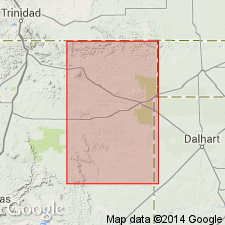
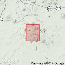
Mapped along Canadian River from T22N, R24E in Mora Co in Las Vegas-Raton basin to T21N, R24E on Mora-Harding Co line, on Sierra Grande uplift. Ranges from 40 to 110 ft thick. Overlies Dockum Formation. Underlies Bell Ranch Formation. Assigned a Middle Jurassic age. Name used in map area [which is south of its type along Dry Cimarron] in preference to Entrada Sandstone, a UT, western CO, northern AZ, and northwest NM name, because stratigraphic meaning of Entrada-Exeter correlation is not well understood.
Source: GNU records (USGS DDS-6; Denver GNULEX).
- Usage in publication:
-
- Exeter Sandstone*
- Modifications:
-
- Areal extent
- AAPG geologic province:
-
- Las Vegas-Raton basin
Summary:
Mapped in Temple Dome in southeast corner of quad, secs 1, 2, 11, and 12, T26N, R26E, Colfax Co, NM in Las Vegas-Raton basin. Overlies Dockum Formation; underlies Morrison Formation. Of Middle Jurassic age.
Source: GNU records (USGS DDS-6; Denver GNULEX).
- Usage in publication:
-
- Exeter Member
- Modifications:
-
- Overview
- Dominant lithology:
-
- Sandstone
- AAPG geologic province:
-
- Sierra Grande uplift
Summary:
Assigned to Entrada Sandstone as its upper member in the Dry Cimarron valley of northeast NM. Type section designated and measured in SW1/4 SW1/4 SE1/4 sec 28, T32N, R35E, Union Co, NM on Sierra Grande uplift where Exeter: is 5.2 m thick; consists of white, yellow-gray to pale-orange, medium-, fine- to very fine grained, very poorly to well sorted, well-rounded, very calcareous, friable, massive, ledge-forming quartzose sandstone; overlies the "notch," a soft, very fine grained, laminar quartzarenite that forms a topographic notch between main body of Entrada below and Exeter above; disconformably underlies Bell Ranch Formation. This same section was described by Lee (1902). The "notch" may represent landward equivalent of the Todilto Salina basin. The Exeter occupies same position as Cow Springs and the "Buff Sandstone" of west-central NM. Thought to be of middle or late Callovian age. Cross section.
Source: GNU records (USGS DDS-6; Denver GNULEX).
For more information, please contact Nancy Stamm, Geologic Names Committee Secretary.
Asterisk (*) indicates published by U.S. Geological Survey authors.
"No current usage" (†) implies that a name has been abandoned or has fallen into disuse. Former usage and, if known, replacement name given in parentheses ( ).
Slash (/) indicates name conflicts with nomenclatural guidelines (CSN, 1933; ACSN, 1961, 1970; NACSN, 1983, 2005, 2021). May be explained within brackets ([ ]).