- Usage in publication:
-
- Evening Star Formation
- Modifications:
-
- Named
- Dominant lithology:
-
- Conglomerate
- Sandstone
- Mudstone
- Fanglomerate
- Gravel
- AAPG geologic province:
-
- Great Basin province
Summary:
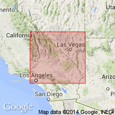
Named for Evening Star Mine by McMackin (1987, Extensional tectonics of the Kingston Range and Mesquite Mountains: reinterpretation of the Winters Pass fault: unpublished Master's thesis, University of California at Davis, 109 p.). Type locality is area of exposures near Evening Star Mine in western Shadow Mountains. Appears to be restricted to Kingston Wash, and southward to Shadow Mountains, and Halloran Hills, all in San Bernardino Co, east-central CA. In general, constitutes coarsening-upward cycle, changing (up section) from interbedded mudstone and sandstone to upper cobble-and-boulder conglomerate or fanglomerate. Lower units are interbedded lithic and volcaniclastic sandstone, shale, and mudstone. Sandstone beds (decimeters thick) show scoured and channeled bases, trough cross-bedding, planar lamination, and some planar cross-bedding. Finer clastics form planar beds and lens-shaped channel-fill deposits. Bedding surfaces display current and wave ripple marks, desiccation cracks, and tracks of large mammals (McMackin, 1991). Higher in section interbedded pebbly sandstone and pebble conglomerate (decimeters to meters thick) display shallow channel fill, trough and planar cross-bedding, and flat lamination. Gravels occur. Thickest exposures at Shadow Mountains measure about 1000 m, while thickest sections in Kingston Wash are >1000 m. Unconformably overlies middle and late Miocene Resting Spring Formation of Hewett, 1956 (revised). Unconformably underlies late Miocene Coyote Holes Formation (new). Age inferred late Miocene based on stratigraphic position. Report includes geologic sketch map and cross sections.
Source: GNU records (USGS DDS-6; Menlo GNULEX).
For more information, please contact Nancy Stamm, Geologic Names Committee Secretary.
Asterisk (*) indicates published by U.S. Geological Survey authors.
"No current usage" (†) implies that a name has been abandoned or has fallen into disuse. Former usage and, if known, replacement name given in parentheses ( ).
Slash (/) indicates name conflicts with nomenclatural guidelines (CSN, 1933; ACSN, 1961, 1970; NACSN, 1983, 2005, 2021). May be explained within brackets ([ ]).

