

- Usage in publication:
-
- Evacuation Creek member*
- Modifications:
-
- Named
- Dominant lithology:
-
- Shale
- Marlstone
- AAPG geologic province:
-
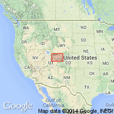
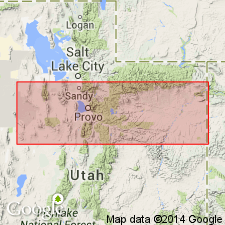
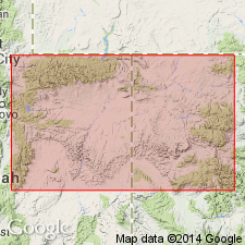
- Uinta basin
- Piceance basin
Summary:
Named as upper member of Green River formation for excellent exposures east of Bitter Creek, in Uintah Co, UT, on Evacuation Creek, T2S, R25E in Uintah Co, in the Uinta basin. Extends eastward into Piceance Creek, Rio Blanco Co, CO in Piceance basin. No type locality designated. Is 530 ft thick along the White River of UT and at least 840 ft thick near Piceance Creek, CO. Consists chiefly of barren [of oil-shale] shale and marlstone that weathers brown or brown gray. Forms gently rounded slopes broken by irregular discontinuous ledges. Shale is limy, thin-bedded, platy or chippy, and locally sandy. Marlstone is sandy. Has a few claystone and medium-grained dark brown sandstone beds. The oil-shale beds present are too thin and too discontinuous to be valuable. Fossiliferous: adult insects, leaves, larvae-bearing beds. Of middle Eocene age. Geologic map. Cross section. Columnar sections.
Source: GNU records (USGS DDS-6; Denver GNULEX).
- Usage in publication:
-
- Evacuation Creek member*
- Modifications:
-
- Areal extent
- Overview
- Revised
- AAPG geologic province:
-
- Uinta basin
- Piceance basin
Summary:
Name used as the upper member of the Green River formation and extended from Wasatch Co, UT east to Duchesne and Uintah Cos in the Uinta basin into adjoining CO in the Piceance basin. Horse Bench sandstone, which lies 175 ft above the base of the Evacuation Creek member of this report, is newly assigned to the Evacuation Creek; Horse Bench was previously in the upper shaly facies of the Green River. Recognized as discontinuous sandstone in the western sections and may not strictly be the Horse Bench though the discontinuous sandstone beds occupy the same stratigraphic position as the Horse Bench of the eastern sections. Beds in the Evacuation Creek below the Horse Bench contain gradational lithologies from the Parachute Creek member of the Green River to the Horse Bench, and they are uniform in character and thickness (180-215 ft). Beds above the Horse Bench represent reversion to deeper water conditions for a short time before return to pre-Horse Bench conditions. Extent of lithologies discussed. Upper contact transitional and arbitrary with Uinta formation. Eocene age. Is a lacustrine deposit.
Source: GNU records (USGS DDS-6; Denver GNULEX).
- Usage in publication:
-
- Evacuation Creek Member†
- Modifications:
-
- Abandoned
Summary:
Is the same unit as Parachute Creek Member of Green River Formation at its type locality in Garfield Co, CO. Rock bodies called Parachute Creek and Evacuation Creek, though separate now, were probably once one laterally continuous body of interfingering fluvial and lacustrine sediments derived from a northerly or northeasterly source. Abandoned as a formal name. Replaced by Parachute Creek Member in the Uinta basin and by Uinta Formation in Piceance basin.
Source: GNU records (USGS DDS-6; Denver GNULEX).
For more information, please contact Nancy Stamm, Geologic Names Committee Secretary.
Asterisk (*) indicates published by U.S. Geological Survey authors.
"No current usage" (†) implies that a name has been abandoned or has fallen into disuse. Former usage and, if known, replacement name given in parentheses ( ).
Slash (/) indicates name conflicts with nomenclatural guidelines (CSN, 1933; ACSN, 1961, 1970; NACSN, 1983, 2005, 2021). May be explained within brackets ([ ]).