- Usage in publication:
-
- Eureka limestone*
- Modifications:
-
- First used
- Dominant lithology:
-
- Limestone
- AAPG geologic province:
-
- Great Basin province
Summary:
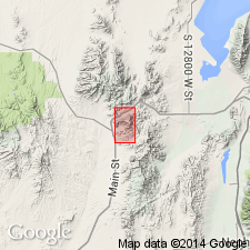
First published use as a map unit composed of blue to gray, impure, sandy, shaly to dolomitic limestone. Is generally thin bedded. Some beds have many seams of calcite; some have seams of chert. Also contains impure thinly bedded dolomite that varies from yellowish-gray to bluish-black called "ribbon limestone", and a clay shale near base in a section 3,970 ft thick measured between east side of Eureka Peak to Quartzite Ridge, T10S, Rs2 to 3W, Juab Co, UT in the Great Basin province. Occurs in the central and northwest part of the geologic map stratigraphically above Robinson quartzite (first used) and beneath Godiva limestone (first used). Lower part is generally dense blue, black, gray, giving the appearance of thin-bedded strata; the mid-section is gray dolomitic limestone with occasional chert lenses, and the upper part is shaly and dolomitic weathering with a reddish tinge. Some oolitic, foraminifers and crinoid stems. Probably deposited in quiet water. Intent to name, selection of geographic name [probably Eureka Peak], and designation of type locality not stated. Assumed to be Lower Carboniferous. Footnote states that Eureka will be renamed Mammoth formation.
Source: GNU records (USGS DDS-6; Denver GNULEX).
For more information, please contact Nancy Stamm, Geologic Names Committee Secretary.
Asterisk (*) indicates published by U.S. Geological Survey authors.
"No current usage" (†) implies that a name has been abandoned or has fallen into disuse. Former usage and, if known, replacement name given in parentheses ( ).
Slash (/) indicates name conflicts with nomenclatural guidelines (CSN, 1933; ACSN, 1961, 1970; NACSN, 1983, 2005, 2021). May be explained within brackets ([ ]).

