The National Geologic Map Database is migrating to a new infrastructure. We apologize for any service disruptions during this process.
|
|---|


- Usage in publication:
-
- Eureka quartzite*
- Modifications:
-
- Named
- Dominant lithology:
-
- Quartzite
- AAPG geologic province:
-
- Great Basin province
Summary:
Eureka quartzite is named for the development at Eureka, NV. Compact vitreous quartzite. Is white and blue, passing into reddish tints at base; indistinctly bedded. Thickness is 500 ft. Unconformably overlain by Lone Mountain limestone (new) and underlain by Pogonip limestone. Age is Middle Ordovician.
Source: GNU records (USGS DDS-6; Menlo GNULEX).
- Usage in publication:
-
- Eureka quartzite
- Modifications:
-
- Contact revised
- Overview
- AAPG geologic province:
-
- Great Basin province
Summary:
Lower contact revised in west-central UT, Great Basin province in that Middle Ordovician Eureka overlies the newly named Crystal Peak dolomite. Cross section. Measured sections. Isopach map of all the Middle Ordovician quartzites. Present in both western UT and eastern NV. At Lone Mountain section, T20N, R51E, Eureka Co, NV, is restricted to the 181 ft thick brown, hard, vitreous, massive, cross-bedded quartzite and quartz sandstone that lies above an unnamed formation of quartz sandstone and sandy dolomite 43 ft thick that has been included in the Eureka, and beneath the Hanson Creek Formation. Probably separated from the unnamed formation at Lone Mountain by a disconformity. In UT, is 535 ft thick at Ibex Canyon, 467 ft thick at the Desert Range Experiment Station, 380 ft thick in Tule Canyon, 137 ft thick at Kenosh, 155 ft thick at Scipio, 160 ft thick at Fish Springs. In NV, is 451 ft thick in the southern Snake Range, 521 ft thick at Cave Valley, 513 ft thick at Sunnyside, 344 ft thick at Hiko, 339 ft thick at Steptoe, 405 ft thick in the Grant Range, 448 ft thick in White Pine Range.
Source: GNU records (USGS DDS-6; Denver GNULEX).

- Usage in publication:
-
- Eureka Quartzite*
- Modifications:
-
- Geochronologic dating
- AAPG geologic province:
-
- Great Basin province
Summary:
Pg. 28, geologic time scale (inside front cover). Eureka Quartzite (Ordovician). Quartzite sample from IBEX well, [approx.] Lat. 38 deg. 45 min. N., Long. 113 deg. 40 min. W., Crystal Peak quadrangle, Millard County, Utah, yielded a Pb-alpha age of 2,370 +/-300 Ma (zircon), indicating average age of source rocks [Precambrian]. Age calculated using decay constants of Steiger and Jager, 1977 (Earth Planet. Sci. Letters, v. 36, p. 359-362).
Source: Publication.
- Usage in publication:
-
- Eureka Quartzite*
- Modifications:
-
- Areal extent
- AAPG geologic province:
-
- Great Basin province
Summary:
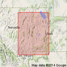
Areally extended into the southern Dog Valley Mountain Range, west-central UT in the Great Basin province where it overlies the Middle and Early Ordovician Pogonip Group and underlies the Late Ordovician Fish Haven Dolomite. Assigned a Middle Ordovician age.
Source: GNU records (USGS DDS-6; Denver GNULEX).

- Usage in publication:
-
- Eureka Quartzite*
- Modifications:
-
- Mapped 1:24k
- Dominant lithology:
-
- Quartzite
- Sandstone
- AAPG geologic province:
-
- Great Basin province
Summary:
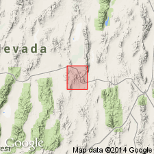
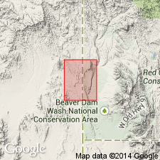
Is Middle Ordovician formation mapped in limited area in the southeast part of map area in vicinity of The Needles, Beaver Co, southwest UT (Great Basin province). Is shown in subsurface in cross sections of southern Mountain Home Range in western Millard and Beaver Cos, southwest UT. Overlies Pogonip Group (Lower and Middle Ordovician). Is overlain by Ely Springs Dolomite (Upper Ordovician). Map unit described as light-gray, medium- to fine-grained orthoquartzite and quartz sandstone weathering orangish to reddish brown. Characteristically pock-marked with scattered pits about 1 cm in diameter. Commonly forms cliffs and ledges; typically brecciated and attenuated near faults. Thickness in nearby Tunnel Spring quad. [USGS MF-1334] (Hintze, 1981) ranges from 140 to 220 m.
Source: GNU records (USGS DDS-6; Denver GNULEX).
- Usage in publication:
-
- Eureka Quartzite*
- Modifications:
-
- Areal extent
- Overview
- AAPG geologic province:
-
- Great Basin province
Summary:
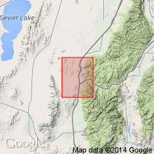
Extended into Lincoln Co, NV, Great Basin province. Consists of quartzite, fine- to medium-grained; cross bedded. Forms resistant ledge; weathers dark brownish gray. Best exposed in sec 8, T9S, R71E, where it is 15 m thick. Unit is attenuated by brittle fracturing in its exposures on west side of Snow Spring Wash and in most exposures in Tule Springs Hills. Conformably overlies upper part of Pogonip Group; conformably underlies undivided Upper Ordovician and Silurian dolomites. Middle Ordovician age.
Source: GNU records (USGS DDS-6; Denver GNULEX).
For more information, please contact Nancy Stamm, Geologic Names Committee Secretary.
Asterisk (*) indicates published by U.S. Geological Survey authors.
"No current usage" (†) implies that a name has been abandoned or has fallen into disuse. Former usage and, if known, replacement name given in parentheses ( ).
Slash (/) indicates name conflicts with nomenclatural guidelines (CSN, 1933; ACSN, 1961, 1970; NACSN, 1983, 2005, 2021). May be explained within brackets ([ ]).