

- Usage in publication:
-
- Espy formation
- Modifications:
-
- Original reference
- Dominant lithology:
-
- Limestone
- Sandstone
- AAPG geologic province:
-
- Permian basin
Summary:
Pg. 992 (fig. 2), 1004-1007, pl. 1. Espy formation of Washita Group. Consists of 3 unnamed members: lowest, 679.5 feet thick, is primarily light- to dark-gray and bluish limestone, slightly arenaceous, with small lentils and thin intercalated layers of shale and sandy shale; middle, 340.5 feet thick, consists of platy white thin-bedded to laminated arenaceous to argillaceous limestone; upper, about 266.5 feet thick, is principally buff and olive-brown sandstone. At type locality, where exposed thickness is 1,021 feet, it is chiefly thin beds of almost pure dense gray limestone, with buff marly limestone, brown sandstone, and a few interbedded shale layers. In northern Quitman Mountain area, base is not exposed, and consequently relationships to underlying formations of Fredericksburg group are not certainly known; in adjacent areas, relations appear conformable; in northern Quitman Mountain area, conformably underlies Etholen formation with sharp contact; in Devils Ridge area, conformably underlies group of shales designated as Eagle Ford. Age is Early Cretaceous.
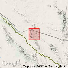
Type locality: low hills upheld by Washita strata east of Love Hogback and southeastern part of Devil Ridge, northern Quitman Mountains, Hudspeth Co., western TX. Named from Espy Ranch about 10 mi east of Love Hogback.
Source: US geologic names lexicon (USGS Bull. 1200, p. 1287-1288).
For more information, please contact Nancy Stamm, Geologic Names Committee Secretary.
Asterisk (*) indicates published by U.S. Geological Survey authors.
"No current usage" (†) implies that a name has been abandoned or has fallen into disuse. Former usage and, if known, replacement name given in parentheses ( ).
Slash (/) indicates name conflicts with nomenclatural guidelines (CSN, 1933; ACSN, 1961, 1970; NACSN, 1983, 2005, 2021). May be explained within brackets ([ ]).