- Usage in publication:
-
- Espiritu Santo formation*
- Modifications:
-
- Original reference
- Dominant lithology:
-
- Sandstone
- Limestone
- Chert
- AAPG geologic province:
-
- Palo Duro basin
- Estancia basin
- Las Vegas-Raton basin
- San Luis basin
Summary:
Pg. 1752-1759, 1766 (fig. 12), 1770, 1771-1772. Espiritu Santo formation. Name applied to sequence of sandstone, arenaceous limestone, calcarenite, and crystalline dolomitic limestone overlying crystalline rocks of Precambrian age near confluence of Holy Ghost Creek (formerly called Espiritu Santo Creek) and Pecos River at Tererro. Thickness ranges from a trace to 80+ feet. Thickness at type locality more than 30 feet; consists of basal sandstone more than 11 feet thick, overlain by interbedded thin sandstone, calcarenite, and sandy limestone 5 feet thick; thin-bedded dolomitic limestone 11 feet thick; at top, sandy limestone, shale, and limestone pebble conglomerate 3.5 feet thick. Unconformably underlies Tererro formation (new). Correlated with Devonian rocks on the basis of lithology and stratigraphy only; therefore classed as Devonian(?). Further studies must precede correlation, firm age assignments, and adjustments in terminology of Espiritu Santo, Tererro, and Arroyo Penasco formations.
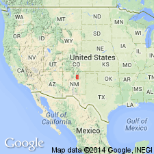
Type locality: in quarry west of Pecos River about 75 yds north of Holy Ghost Creek (formerly called Espiritu Santo Creek) at Tererro, San Miguel Co., northern NM. Named from former name of creek, Espiritu Santo. Present throughout much of Sangre de Cristo Mountains, in Taos, Mora, San Miguel, and Santa Fe Counties, New Mexico.
Source: US geologic names lexicon (USGS Bull. 1200, p. 1287); supplemental information from GNU records (USGS DDS-6; Denver GNULEX).

- Usage in publication:
-
- Espiritu Santo Formation
- Modifications:
-
- Redescribed
- Revised
- Age modified
- Dominant lithology:
-
- Limestone
- Dolomite
- AAPG geologic province:
-
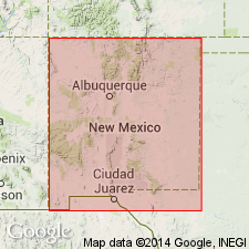
- Many basins
Summary:
Espiritu Santo Formation is redescribed and revised, and its age is modified--basal sandstone bed of Espiritu Santo as described by Baltz and Read (1960) named Del Padre Sandstone in this report, and Espiritu Santo Formation is restricted to that part of the original formation composed primarily of limestone and dolomite. Well exposed at type locality near Tererro in San Miguel Co, NM, Palo Duro basin. Conformably overlies Del Padre Sandstone; upper part of Del Padre interfingers with Espiritu Santo, of which it is partly a lateral equivalent. Unconformably overlain by Macho Member of Mississippian Tererro Formation with distinctive undulating contact. Is basically limestone which has been almost completely recrystallized or dolomitized. Changes laterally in thickness; maximum thickness 50 ft at Nambe Falls, Santa Fe Co, Estancia basin; gradually thins northward in Pecos Valley. This thinning coincides with a corresponding increase in thickness of underlying Del Padre. 7 ft thick at Jacks Creek and in high mountain country [near Pecos Baldy], Santa Fe Co. Thick and typically developed in northern part of map area at Rio Pueblo (39 ft thick), and near Talpa (39 ft thick), Taos Co, San Luis basin. Age unknown; as with Del Padre Sandstone, could be any age from late Precambrian (postmetamorphic) to Early Mississippian. Therefore, the tentative age assigned by Baltz and Read (1960) of Devonian? is inadvisable. Measured sections, geologic map.
Source: GNU records (USGS DDS-6; Denver GNULEX).

- Usage in publication:
-
- Espiritu Santo*
- Modifications:
-
- Age modified
- Biostratigraphic dating
- Revised
- AAPG geologic province:
-
- San Juan basin
- Palo Duro basin
- Las Vegas-Raton basin
- Estancia basin
Summary:
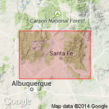
Espiritu Santo Formation revised--assigned as lowermost of two formations (Espiritu Santo and Tererro) of Arroyo Penasco Group (raised in rank to group) and includes, at base, Del Padre Sandstone Member (reduced in rank from Sandstone to Sandstone Member) of probable late Tournaisian (Osagean, Early Mississippian) age, a unit which has been observed in every section measured in this report. Overlying carbonate rocks of Espiritu Santo, with which Del Padre interfingers, are also of late Tournaisian age (ages of both are based on microfossils). Del Padre unconformably overlies Precambrian igneous and metamorphic rocks everywhere; unconformably underlies rocks of Tererro Formation (revised, age modified) in western part of report area--San Pedro Mountain, Nacimiento and Jemez Mountains (Rio Arriba and Sandoval Cos, San Juan basin, NM). Unconformably underlies Log Springs Formation in Sandia Mountains (Bernalillo and Sandoval Cos, Estancia and San Juan basins) and Jemez Mountains (Sandoval Co, San Juan basin). Unconformably underlies Macho Member of Tererro in eastern part of report area--at Mora Gap (Mora Co, Las Vegas-Raton basin); Coco City (Sangre de Cristo Mountains, Mora Co, Las Vegas-Raton basin); Jack's Creek (Sangre de Cristo Mountains, San Miguel Co, Palo Duro basin); and Tererro (San Miguel Co, Palo Duro basin). [May also be elsewhere--areal limits not clearly stated]. Correlations, sections, discussion of deposition.
Source: GNU records (USGS DDS-6; Denver GNULEX).

- Usage in publication:
-
- Espiritu Santo Formation*
- Modifications:
-
- Areal extent
- AAPG geologic province:
-
- Las Vegas-Raton basin
- Palo Duro basin
Summary:
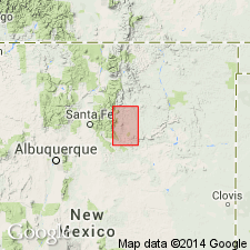
Mapped undifferentiated as lower formation of Arroyo Penasco Group in southeastern Sangre de Cristo Mountains, Mora and San Miguel Cos, NM, Las Vegas-Raton and Palo Duro basins. Widely distributed in mapped area though is absent locally due to erosion. Consists of Del Padre Sandstone Member in lower part and unnamed carbonate in upper part. Del Padre is buff, grayish-olive, and tan, fine to very coarse grained sandstone that contains granules and, commonly, small pebbles; represents littoral deposit of shallow, transgressing sea. Upper carbonate part of Espiritu Santo conformably overlies Del Padre and consists of gray to dark-gray, fine- to coarse-grained, dense limestone and dolomitic limestone that in places is sandy in lower part (sandy dolomitic limestone unit of Baltz and Read, 1960); lithology and lack of megafossils suggests shallow marine deposition in highly saline water. Thickness ranges up to 33 ft. Measured sections. Unconformably underlies Tererro Formation of Arroyo Penasco; unconformably overlies undivided Proterozoic rocks. Assigned Early Mississippian (Osagean) age on basis of microfossil zonation of Armstrong and Mamet (1979).
Source: GNU records (USGS DDS-6; Denver GNULEX).
For more information, please contact Nancy Stamm, Geologic Names Committee Secretary.
Asterisk (*) indicates published by U.S. Geological Survey authors.
"No current usage" (†) implies that a name has been abandoned or has fallen into disuse. Former usage and, if known, replacement name given in parentheses ( ).
Slash (/) indicates name conflicts with nomenclatural guidelines (CSN, 1933; ACSN, 1961, 1970; NACSN, 1983, 2005, 2021). May be explained within brackets ([ ]).

