

- Usage in publication:
-
- Espinaso volcanics
- Modifications:
-
- Areal extent
- Dominant lithology:
-
- Volcanics
- Breccia
- Conglomerate
- Tuff
- AAPG geologic province:
-
- Estancia basin
- San Juan basin
Summary:
Pg. 304 (fig. 2), 309-310. Espinaso volcanics. Includes water-laid breccia, conglomerate, and tuff, with massive flows and explosive material in subordinate amounts. Thickness more than 1,000 feet. Overlies Galisteo formation with contact transitional; unconformably underlies Santa Fe formation. Name credited to Kirk Bryan and J.E. Upson (unpub. ms.).
Source: US geologic names lexicon (USGS Bull. 1200, p. 1286-1287).
- Usage in publication:
-
- Espinaso volcanics
- Modifications:
-
- Principal reference
- AAPG geologic province:
-
- Estancia basin
- San Juan basin
Summary:
Espinaso volcanics. Comprises detrital beds deposited by mud flows and streams radiating from centers of contemporaneous eruption in Ortiz Mountains and Cerrillos Hills, with a few interbedded lava flows. Overlies Galisteo formation with out stratigraphic break; hence, assigned to Duchesnean (latest Eocene). Thickness as much as 1,450 feet. Underlies Abiquiu(?) formation. Older than Cieneguilla limburgite (new) and separated from it by time interval during which a small body of augite quartz latite was intruded, solidified, and exposed by subsequent erosion. Type locality stated.
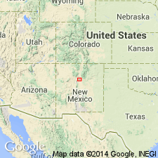
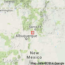
Type locality: Espinaso Ridge along Arroyo Pinovetito. Espinaso de Clotero Montoya (also known as Pinovetito Ridge) is hogback 5 mi long, 11 mi southeast of Cerrillos, Santa Fe Co., northwestern NM.
Source: US geologic names lexicon (USGS Bull. 1200, p. 1286-1287).
- Usage in publication:
-
- Espinaso Formation
- Modifications:
-
- Geochronologic dating
- AAPG geologic province:
-
- San Juan basin
- Estancia basin
Summary:
A general description of lithology, depositional environment, and age in Hagan basin which lies in Santa Fe and Bernalillo Cos, NM in Estancia basin, and in Sandoval Co, NM in San Juan basin. Is a 430 m thick unit of nonvolcanic synorogenic origin derived from Ortiz magmatic center (southern source) and from Cerillos magmatic center (northern source). Conformably and gradationally overlies Galisteo Formation. Underlies Santa Fe Group. Composed of water laid immature volcaniclastic sandstones, conglomerates, boulder conglomerates interbedded with matrix-supported, pebble to boulder, debris-flow deposits. Some air-fall and ash-flow deposits interbedded locally. Clasts in conglomerates are andesitic to latitic. Lithic fragments in sandstone are mostly plagioclase, and intermediate to felsic rocks. Fine grain size and upward-fining megasequences in upper part suggest waning volcanic activity, decrease of paleoslope, and lower relief in source areas. Deposited on prograding fans by braided streams and laharic flows. Radial patterns from paleocurrent measurements suggest deposition by two coalescing alluvial fans. Three new K-Ar ages reported: 34.6 +/-0.7 m.y. (near middle), 34.3 +/-0.8 m.y. (near base), and 26.9 +/-0.6 m.y. (near top). Age also framed by a new K-Ar age of 25.1 +/-0.6 m.y. at base of overlying Santa Fe. Of Oligocene age.
Source: GNU records (USGS DDS-6; Denver GNULEX).
For more information, please contact Nancy Stamm, Geologic Names Committee Secretary.
Asterisk (*) indicates published by U.S. Geological Survey authors.
"No current usage" (†) implies that a name has been abandoned or has fallen into disuse. Former usage and, if known, replacement name given in parentheses ( ).
Slash (/) indicates name conflicts with nomenclatural guidelines (CSN, 1933; ACSN, 1961, 1970; NACSN, 1983, 2005, 2021). May be explained within brackets ([ ]).