- Usage in publication:
-
- Espanola Formation
- Modifications:
-
- Named
- Dominant lithology:
-
- Sand
- Silt
- AAPG geologic province:
-
- San Juan basin
Summary:
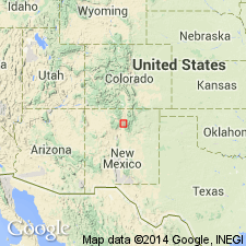
Named for town of Espanola, Rio Arriba Co, NM in San Juan basin, near which unit is well exposed. Type locality designated about 240 ft north of the General Land Office survey stake MC7, SCG, sec 31, T21N, R9E, Rio Arriba Co. Espanola Formation is a Pleistocene remnant which caps the ridge along the west side of First Wash (Arroyo del Llano). Consists of windblown sand or silt with a distinctly brownish color. Is easily distinguished from the underlying Pojoaque Member (new) of Tesuque Formation (revised) of Santa Fe Group, because the Pleistocene sediments lack the light pink, buff, or flesh color of the beds of the Santa Fe Group. The Pleistocene remnants are loess-like in that they tend to stand with vertical faces, except where weathering is advanced. Several kinds of small invertebrates have been collected at the type locality. Erosion of the beds of the Santa Fe Group produced surfaces of considerable relief prior to the deposition of Espanola Formation. Field relations at the type locality suggest that Espanola accumulated in a small valley that had been cut in the Pojoaque Member. Similar deposits occur at widely separated points from El Rito to Santa Fe--may be considered essentially equivalent to Espanola of the type locality. Espanola must once have been very extensive--eventual correlation with loess and loess-like deposits of the Great Plains east of Sangre de Cristo Range seems likely. Pleistocene age.
Source: GNU records (USGS DDS-6; Denver GNULEX).
For more information, please contact Nancy Stamm, Geologic Names Committee Secretary.
Asterisk (*) indicates published by U.S. Geological Survey authors.
"No current usage" (†) implies that a name has been abandoned or has fallen into disuse. Former usage and, if known, replacement name given in parentheses ( ).
Slash (/) indicates name conflicts with nomenclatural guidelines (CSN, 1933; ACSN, 1961, 1970; NACSN, 1983, 2005, 2021). May be explained within brackets ([ ]).

