The National Geologic Map Database is migrating to a new infrastructure. We apologize for any service disruptions during this process.
|
|---|


- Usage in publication:
-
- Espada formation
- Modifications:
-
- Original reference
- Dominant lithology:
-
- Shale
- Sandstone
- AAPG geologic province:
-
- Santa Maria basin
Summary:
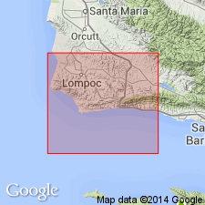
Pg. 22-23, pls. 1, 2. Espada formation. A series of dark-greenish-brown, thin-bedded silty shales and a lesser amount of thin interbeds of hard fine-grained sandstone; locally thin lenses of conglomerate with well-rounded chert pebbles. No complete section exposed at any one locality. At type locality where base is exposed, consists of 1 to 5 feet of dark-brown conglomeratic sandstone resting unconformably on highly sheared clay shale of Honda formation (new); conglomerate is overlain by about 4,000 feet of dark-greenish-brown shale and thin hard sandstone which is unconformably overlain by lower Miocene beds. In San Lucas and Wons Canyons, a maximum thickness of 6,800 feet is exposed; base is in fault or intrusive contact with serpentine; top is unconformably overlain by Eocene beds. Relationship of Espada to Upper Cretaceous Jalama formation (new) not definitely known; but these are believed to be in contact at head of Salsipuedes Canyon, where relationship appears to be an unconformity, and at Nojoqui Canyon, where shales of Espada are in conformable contact with sandstones and shales believed to be the Jalama. Age of Espada is Late Jurassic and Early Cretaceous.
Type locality (basal part of formation): south side of Canada Honda [Creek] about 3 mi east of Point Pedernales, [Tranquillon Mountain 7.5-min quadrangle], Santa Barbara Co., southern CA. Other exposures: Salsipuedes and El Jaro Canyons, Nojoqui and Alisal Canyons, San Lucas and Wons Canyons.
[Probably named from The Espada (=? area of historic Ranchos Espada), in southeastern part of Tranquillon Mountain 7.5-min quadrangle, Santa Barbara Co., southern CA.]
Source: Publication; US geologic names lexicon (USGS Bull. 1200, p. 1285).
For more information, please contact Nancy Stamm, Geologic Names Committee Secretary.
Asterisk (*) indicates published by U.S. Geological Survey authors.
"No current usage" (†) implies that a name has been abandoned or has fallen into disuse. Former usage and, if known, replacement name given in parentheses ( ).
Slash (/) indicates name conflicts with nomenclatural guidelines (CSN, 1933; ACSN, 1961, 1970; NACSN, 1983, 2005, 2021). May be explained within brackets ([ ]).