- Usage in publication:
-
- Esopus shales
- Modifications:
-
- Named
- Dominant lithology:
-
- Shale
- Slate
- AAPG geologic province:
-
- Appalachian basin
Summary:
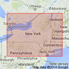
Pg. 209-210, 244-245 (geology of Albany Co.), 302 (geol. of Ulster Co.) [=p. 403-404, 438-439, 496 of Ann. Rpt. of Regents, no. 47].
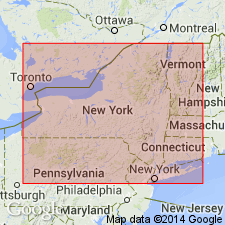
Esopus shales (CAUDA-GALLI grit). The shales and slates which have been known as "Cauda-galli grit" attain maximum development in [eastern] New York about Catskill and Kingston; thinning gradually to 70 feet at Schoharie; 40 feet near Jordansville, north of Richfield Springs; 3 feet at Columbia, northwest of Richfield Springs; and are entirely absent at Litchfield, 8 miles farther west. This rock expands greatly in New Jersey. Thickness at Clarksville [Albany County, New York], 110 feet; in Ulster County, 200 to 300 feet. In order to have a locality designation for Cauda-galli grit, the State Geologist [James Hall] has suggested Esopus slate, from Esopus settlement, of which the portion now known as Kingston is largely on this formation; and Esopus Creek, along which, for some miles above Saugerties [Ulster County], the slates are particularly well exposed. Is in greater part a fine-grained arenaceous deposit of dark-gray color with more or less completely developed slaty cleavage. About Schoharie and westward to its termination it is moderately hard, sandy shale, dark gray or buff to light olive, but east and south, with increasing thickness, the color becomes darker, the texture harder, and slaty cleavage is general. In Helderburg Mountains and westward the shales constitute a slope between shelves of Onondaga limestone above and Oriskany sandstone below, but from southern part of Albany County southward it constitutes high rough ridges. [Age is Early Devonian.]
Source: US geologic names lexicon (USGS Bull. 896, p. 700-701).
- Usage in publication:
-
- Esopus formation
- Modifications:
-
- Revised
- AAPG geologic province:
-
- Appalachian basin
Summary:
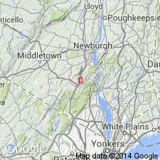
Revised to Esopus formation to include the (ascending) Highland Mills member, a middle member, and Woodbury Creek member. Overlies the Connelly conglomerate and underlies the Kanouse sandstone. Thickness is about 200 feet.
Source: GNU records (USGS DDS-6; Reston GNULEX).
- Usage in publication:
-
- Esopus Formation
- Modifications:
-
- Revised
- AAPG geologic province:
-
- Appalachian basin
Summary:
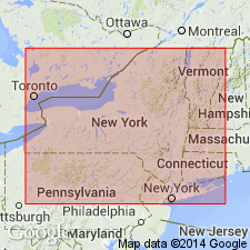
Revised the Esopus Formation to be included in the Stone Ridge Group in NY and NJ. Unit includes the Eddyville, Highland Mills, Quarry Hill, and Mountainville Members. The Esopus is of Early Devonian age.
Source: GNU records (USGS DDS-6; Reston GNULEX).
- Usage in publication:
-
- Esopus Formation*
- Modifications:
-
- Overview
- AAPG geologic province:
-
- Appalachian basin
Summary:
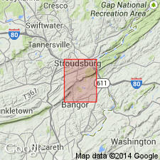
The Esopus Formation in the PA-NJ area consists of medium- to dark-gray, medium-gray-weathering, well-cleaved shaly to finely arenaceous laminated siltstone and lesser silty shale and minor calcareous siltstone. Moderate-yellowish-brown to dark-yellowish-orange iron staining is distinctive. Unit also contains burrows. Thickness is 181 feet. Overlies the Ridgeley Sandstone and Shriver Chert, undivided, and underlies the Schoharie Formation. The Esopus is of Early Devonian age.
Source: GNU records (USGS DDS-6; Reston GNULEX).
- Usage in publication:
-
- Esopus Shale
- Modifications:
-
- Revised
- AAPG geologic province:
-
- Appalachian basin
Summary:
Revised the Esopus Shale to be included in the Tristates Group in NY.
Source: GNU records (USGS DDS-6; Reston GNULEX).
For more information, please contact Nancy Stamm, Geologic Names Committee Secretary.
Asterisk (*) indicates published by U.S. Geological Survey authors.
"No current usage" (†) implies that a name has been abandoned or has fallen into disuse. Former usage and, if known, replacement name given in parentheses ( ).
Slash (/) indicates name conflicts with nomenclatural guidelines (CSN, 1933; ACSN, 1961, 1970; NACSN, 1983, 2005, 2021). May be explained within brackets ([ ]).

