The National Geologic Map Database is migrating to a new infrastructure. We apologize for any service disruptions during this process.
|
|---|


- Usage in publication:
-
- Eskridge shale*
- Modifications:
-
- Original reference
- Dominant lithology:
-
- Shale
- AAPG geologic province:
-
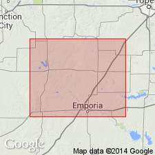
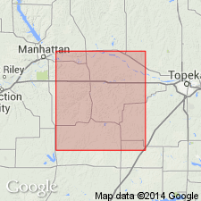
- Forest City basin
Summary:
Pg. 181. Eskridge shale. Name suggested by C.S. Prosser, in unpublished ms., for 30+/- feet of shales overlying Neva limestone and underlying Cottonwood limestone. Age is Late Pennsylvanian.
Named from exposures near Eskridge, Wabaunsee Co., eastern KS.
Source: US geologic names lexicon (USGS Bull. 896, p. 699-700).
- Usage in publication:
-
- Eskridge shales*
- Modifications:
-
- Overview
- Dominant lithology:
-
- Shale
- Limestone
- AAPG geologic province:
-
- Forest City basin
Summary:
Eskridge shales. Shales interbedded with thin limestones. Thickness 30 to 40 feet. Overlies Neva limestone and underlies Cottonwood limestone. Age is late Carboniferous. Report includes fossil list.
Source: Modified from GNU records (USGS DDS-6; Denver GNULEX).

- Usage in publication:
-
- Eskridge shale*
- Modifications:
-
- Overview
- AAPG geologic province:
-
- Forest City basin
Summary:
Eskridge shale. Top formation of Wabaunsee group as used in Kansas for many years, but Kansas and Nebraska Surveys have recently greatly restricted Wabaunsee group. (See USGS unpub. corr. charts of Pennsylvanian and Permian rocks of KS and NE, compiled by M.G. Wilmarth, Secretary of Committee on Geologic Names, Oct. 1936.) Some geologists, including R.C. Moore, 1936, assign this formation to Permian. This change in Permian-Pennsylvanian boundary has not been considered by the USGS for its publications.
Source: US geologic names lexicon (USGS Bull. 896, p. 699-700).

- Usage in publication:
-
- Eskridge shale*
- Modifications:
-
- Areal extent
- AAPG geologic province:
-
- Forest City basin
Summary:
Pg. 47. Eskridge shale of Council Grove group. Shale and minor amount of limestone and locally thin coal beds; red and green shale predominant in most exposures; in central Kansas, a seemingly persistent limestone, as much as 2 feet thick, overlain locally by coaly material and underlain by green shale, occurs a few feet from base. Thickness 20 to 40 feet. Underlies Cottonwood limestone member of Beattie limestone; overlies Neva limestone member of Grenola limestone (redefined). Age is Permian (Wolfcamp).
Source: US geologic names lexicon (USGS Bull. 1200, p. 1282).
- Usage in publication:
-
- Eskridge shale*
- Modifications:
-
- Areal extent
- AAPG geologic province:
-
- Chautauqua platform
Summary:
Pg. 99-100. Eskridge shale of Council Grove group. Formerly considered top unit of Wabaunsee group. Reclassification of section by Moore (1936, Kansas Geol. Survey Bull., no. 22) and others has since placed Eskridge in Council Grove group. Overlies Neva limestone; underlies Cottonwood limestone. Identification of Cottonwood in Pawnee County is uncertain and recognition of upper limit of Eskridge is accordingly doubtful. Thickness 80 to 90 feet, increasing southward. Age is Permian.
Source: US geologic names lexicon (USGS Bull. 1200, p. 1282).
- Usage in publication:
-
- Eskridge shale*
- Modifications:
-
- Principal reference
- AAPG geologic province:
-
- Forest City basin
Summary:
Pg. 13 (table 2), 69-71, pls. Eskridge shale of Council Grove group. Thickness 32.5 to 38 feet in Wabaunsee County, eastern Kansas. Overlies Grenola limestone; underlies Beattie limestone. Age is Permian. Note on type locality and probable type section.
Type locality: vicinity of Eskridge, Wabaunsee Co., eastern KS. Probable type section: about 1 and one-eighth mi south of Eskridge, in SW/4 NW/4 NW/4 sec. 17, T. 14 S., R. 12 E., where upper half of shale is exposed.
Source: US geologic names lexicon (USGS Bull. 1200, p. 1282).
For more information, please contact Nancy Stamm, Geologic Names Committee Secretary.
Asterisk (*) indicates published by U.S. Geological Survey authors.
"No current usage" (†) implies that a name has been abandoned or has fallen into disuse. Former usage and, if known, replacement name given in parentheses ( ).
Slash (/) indicates name conflicts with nomenclatural guidelines (CSN, 1933; ACSN, 1961, 1970; NACSN, 1983, 2005, 2021). May be explained within brackets ([ ]).