- Usage in publication:
-
- Eskota dolomite gypsum
- Modifications:
-
- Original reference
- Dominant lithology:
-
- Gypsum
- Dolomite
- AAPG geologic province:
-
- Permian basin
Summary:
Pl. 10, p. 953. Eskota dolomite gypsum. Massive gypsum beds, 10 to 20 feet thick, underlain by thin dolomite. Has not been followed farthern than central Fisher County, central northern Texas. Lies 120 feet above Childress dolomite and gypsum, and is older than Croton gypsum. Age is Permian.
Probably named from Eskota, Fisher Co., central northern TX.
Source: US geologic names lexicon (USGS Bull. 896, p. 699).

- Usage in publication:
-
- Eskota gypsum
- Modifications:
-
- Overview
- AAPG geologic province:
-
- Bend arch
- Permian basin
Summary:
Pg. 180. Eskota gypsum is a member in Whitehorse-Cloud Chief interval. Age is Permian.
Source: US geologic names lexicon (USGS Bull. 896, p. 699).

- Usage in publication:
-
- Eskota Gypsum
- Modifications:
-
- Overview
- Areal extent
- AAPG geologic province:
-
- Permian basin
Summary:
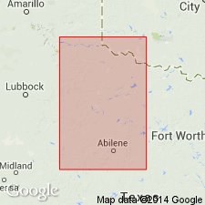
Area of report is central Texas; in this area the Whitehorse Sandstone and Cloud Chief Gypsum are mapped undivided. Separately mapped units of Whitehorse and Cloud Chief include (ascending): Childress Dolomite, Eskota Gypsum, and Claytonville Dolomite. Eskota Gypsum is present in various localities in Fisher County, Texas. Whitehorse, Cloud Chief, and Blaine (undivided) overlie Permian San Angelo Formation and underlie Permian Quartermaster Formation. Assigned to the Permian. Geologic map.
Source: GNU records (USGS DDS-6; Denver GNULEX).

- Usage in publication:
-
- Eskota Gypsum [unranked]
- Modifications:
-
- Mapped 1:250k
- Dominant lithology:
-
- Gypsum
- AAPG geologic province:
-
- Palo Duro basin
- Permian basin
Summary:
Eskota Gypsum [unranked] in middle part of Cloud Chief Gypsum and Whitehorse Sandstone, undivided (Permian). Separately mapped in parts of Cottle, Kent, King, and Stonewall Counties, Texas. Not described. [See also entry under Cloud Chief or Whitehorse.]
Source: Modified from GNU records (USGS DDS-6; Denver GNULEX).
For more information, please contact Nancy Stamm, Geologic Names Committee Secretary.
Asterisk (*) indicates published by U.S. Geological Survey authors.
"No current usage" (†) implies that a name has been abandoned or has fallen into disuse. Former usage and, if known, replacement name given in parentheses ( ).
Slash (/) indicates name conflicts with nomenclatural guidelines (CSN, 1933; ACSN, 1961, 1970; NACSN, 1983, 2005, 2021). May be explained within brackets ([ ]).

