

- Usage in publication:
-
- Eska conglomerate*
- Modifications:
-
- Named
- Dominant lithology:
-
- Conglomerate
- Sandstone
- AAPG geologic province:
-
- Alaska Southern region
Summary:
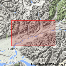
Named for Eska Creek, lower Matanuska Valley, Cook Inlet region, southern AK. Occupies two areas, one extending westward from valley of Eska Creek to Moose Creek, outcropping in cliffs of Wishbone Hill, and the other in Castle Mountain, extending eastward 4 or 5 mi beyond Chickaloon River. Consists predominantly of coarse conglomerate in massive plates interbedded with coarse sandstone. Is about 3000 ft thick. Overlies (without observed unconformity) Chickaloon formation (new). Unconformably underlies basaltic lavas and tuffs. Contains no determinable fossils but age is regarded as Tertiary and probably Miocene(?).
Source: GNU records (USGS DDS-6; Menlo GNULEX).
- Usage in publication:
-
- Eska conglomerate†
- Modifications:
-
- Abandoned
- AAPG geologic province:
-
- Alaska Southern region
Summary:
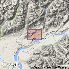
Eska conglomerate of Martin and Katz (1912) is abandoned. Rocks are divided into lower consolidated unit, Wishbone formation and upper less indurated unit, Tsadaka formation, on basis of lithologic dissimilarity and evidence of distinct angular unconformity between the units.
Source: GNU records (USGS DDS-6; Menlo GNULEX).
For more information, please contact Nancy Stamm, Geologic Names Committee Secretary.
Asterisk (*) indicates published by U.S. Geological Survey authors.
"No current usage" (†) implies that a name has been abandoned or has fallen into disuse. Former usage and, if known, replacement name given in parentheses ( ).
Slash (/) indicates name conflicts with nomenclatural guidelines (CSN, 1933; ACSN, 1961, 1970; NACSN, 1983, 2005, 2021). May be explained within brackets ([ ]).