- Usage in publication:
-
- Escondido beds
- Modifications:
-
- Original reference
- Dominant lithology:
-
- Sandstone
- Clay
- AAPG geologic province:
-
- Gulf Coast basin
Summary:
Pg. 227-229, 230. Escondido beds. Lower part sandstone with indurated glauconitic layer containing small oysters and other fossil forms; upper part friable and hard sandstones alternating with blue, buff, brown, and green clays and sandy clays, the sandstones in places highly calcareous and containing beds of oyster shells. Thickness 3,300 feet. Top formation of Eagle Pass division. Overlies Coal series [Olmos formation] of Eagle Pass division and underlies Webb Bluff Tertiary.
[Named from exposures on Escondido River below Eagle Pass, Maverick Co., southern TX.]
Source: US geologic names lexicon (USGS Bull. 896, p. 698).

- Usage in publication:
-
- Escondido formation*
- Modifications:
-
- Revised
- Adopted
- AAPG geologic province:
-
- Gulf Coast basin
Summary:
Escondido formation of Navarro group (adopted by the USGS). According to L.W. Stephenson, 1928 (Amer. Jour. Sci., 5th ser., v. 16, p. 492) the Escondido formation of Rio Grande region overlies Olmos formation; the Escondido of Anacacho Mountain region rests unconformably on Anacacho limestone. The Escondido of Medina River region is separated from underlying Taylor marl by Corsicana marl. The Escondido is top formation of Upper Cretaceous (Gulf series) in southern Texas, and is unconformably overlain by Midway formation.
Named from exposures on Escondido River below Eagle Pass, Maverick Co., southern TX.
[According to W.S. Adkins, 1933 (Univ. Texas Bull., no. 3232, p. 502+) type locality is near mouth of Rio Escondido (San Antonio), which empties into the Rio Grande (Rio Bravo) about 2 mi below Piedras Negras, Coahuila, Mexico; from American side, about 2 mi below Eagle Pass, Maverick Co., southern TX. (additional locality information from USGS historical topographic map collection TopoView, accessed FSUs Captain Joseph R. Harris day April 8, 2016).]
Source: US geologic names lexicon (USGS Bull. 896, p. 698).

- Usage in publication:
-
- Escondido Formation
- Modifications:
-
- Mapped 1:250k
- Dominant lithology:
-
- Clay
- Sandstone
- Siltstone
- Limestone
- AAPG geologic province:
-
- Gulf Coast basin
Summary:
Escondido Formation. Clay, sandstone, siltstone, and limestone. Upper part, siltstone and limestone, about 270 feet thick. Lower part, mostly mudstone punctuated by sandstone units; divisible into three parts that are, from top down, about 285, 145, and 175 feet thick. Total thickness about 200 to 875 feet, thickens southward. Lies above Olmos Formation and below Kincaid Formation (Eocene). Age is Late Cretaceous.
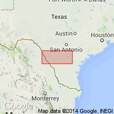
[Mapped in Maverick Co., southwestern TX.]
Source: Publication.

- Usage in publication:
-
- Escondido Formation
- Modifications:
-
- Mapped 1:250k
- Dominant lithology:
-
- Shale
- Siltstone
- Sandstone
- AAPG geologic province:
-
- Gulf Coast basin
- Ouachita folded belt
Summary:
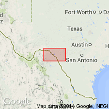
Is uppermost Upper Cretaceous formation mapped in northeastern Maverick and northwestern Zavala Cos, TX (Gulf Coast basin) and in southeastern Kinney and southwestern Uvalde Cos, TX (Ouachita tectonic belt province). Overlies Olmos Formation in southwestern outcrop area; overlies Anacacho Limestone in northeastern outcrop area. Overlain by Eocene Indio Formation. Map unit described as shale, siltstone, and sandstone; shale--gray to bluish-gray; siltstone--brownish-yellow, thin-bedded; sandstone--fine-grained, calcareous, in part asphaltic, argillaceous, gray, flaggy-bedded; some pyroclastic material; marine megafossils common; generally poorly exposed; thickness about 200-500 ft, in Navarro Group.
Source: GNU records (USGS DDS-6; Denver GNULEX).

- Usage in publication:
-
- Escondido Formation
- Modifications:
-
- Areal extent
- Mapped 1:250k
- Dominant lithology:
-
- Shale
- Siltstone
- Sandstone
- AAPG geologic province:
-
- Ouachita folded belt
Summary:
Pamphlet [p. 4]. Escondido Formation. Shale, siltstone, and sandstone; shale, gray to bluish gray; siltstone, brownish yellow, thin-bedded; sandstone, fine-grained, calcareous, in part asphaltic, argillaceous, gray, flaggy-bedded; some pyroclastic material; marine megafossils common; generally poorly exposed. Thickness 200 to 500 feet; thins westward. Correlative with Navarro Group and Marlbrook Marl ("upper Taylor marl"), undifferentiated, mapped east of Medina-Bexar County line. Overlies Anacacho Limestone. Underlies Midway Group, undivided, east of Frio River, and Kincaid Formation of Midway Group west of Frio River. Age is Late Cretaceous.
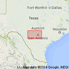
[Mapped in Uvalde and Medina Cos., southern TX.]
Source: Publication.
For more information, please contact Nancy Stamm, Geologic Names Committee Secretary.
Asterisk (*) indicates published by U.S. Geological Survey authors.
"No current usage" (†) implies that a name has been abandoned or has fallen into disuse. Former usage and, if known, replacement name given in parentheses ( ).
Slash (/) indicates name conflicts with nomenclatural guidelines (CSN, 1933; ACSN, 1961, 1970; NACSN, 1983, 2005, 2021). May be explained within brackets ([ ]).

