

- Usage in publication:
-
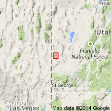
- Escalante Desert Formation
- Modifications:
-
- Revised
- AAPG geologic province:
-
- Great Basin province
Summary:
Divided into the Lamerdorf Member, a newly named unit at base, and the overlying Beers Spring Member (formerly a formation). Geologic maps. Columnar section. Cross sections. Overlies the tuff of Sulphur Spring. Underlies the Cottonwood Wash Tuff Member of the Needles Range Formation. Tertiary age.
Source: GNU records (USGS DDS-6; Denver GNULEX).
- Usage in publication:
-
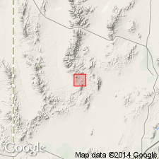
- Escalante Desert Formation
- Modifications:
-
- Named
- Dominant lithology:
-
- Tuff
- Conglomerate
- AAPG geologic province:
-
- Great Basin province
Summary:
Named [presumably for the Escalante Desert]. Type section designated on northeast flank of hill 6535, sec 6, T32S, R14W, Iron Co, UT in the Great Basin province. Lies above an unnamed volcanic conglomerate or the tuff of Frisco [whose ages are not stated] and beneath the Wah Wah Springs Member of Needles Range Formation. Consists of a series of relatively crystal-poor ash-flow tuffs and some intercalated epiclastic and pyroclastic beds. Has a volcanic conglomerate bed at top. Ash flows divided into beds A-F. Beds A, B, and C are part of the lower member; beds D and E are in the middle member. Bed F and the overlying conglomerate are in the upper member. Members are not persistent. Modal analyses. Cross section. Ash flows of the lower member have fewer crystals than do the younger ash flows, and have sedimentary xenoliths. The middle and upper members have amphibolite-bearing vitrophyres and moderate amount of calcic andesine. Lithic fragments more abundant near base of the three members. Same rock type occurs in northern Needle Range, southern Wah Wah Mountains, and near Indian Peak. Age not stated.
Source: GNU records (USGS DDS-6; Denver GNULEX).
- Usage in publication:
-
- Escalante Desert Formation*
- Modifications:
-
- Adopted
- AAPG geologic province:
-
- Great Basin province
Summary:
Escalante Desert Formation of Grant (1978) is adopted with the revisions of Campbell (1978). Overlies andesitic lavas; underlies the Needles Range Formation. Age is Oligocene.
Source: GNU records (USGS DDS-6; Menlo GNULEX).
- Usage in publication:
-
- Escalante Desert Formation*
- Modifications:
-
- Mapped 1:24k
- Dominant lithology:
-
- Rhyolite
- Andesite
- AAPG geologic province:
-
- Great Basin province
Summary:
Is mapped as lower formation (of two) of the Needles Range Group (Oligocene) in western Millard Co, southwestern UT (Great Basin province). Unconformably overlies Ely Limestone (Lower Permian, Pennsylvanian, Upper Mississippian). Overlain by Cottonwood Wash Tuff of Needles Range Group. Map unit described as rhyolite ash-flow tuff with less than 5 percent lithic fragments and 10 percent plagioclase and 2 percent biotite phenocrysts; moderately welded, pinkish gray; includes a platy dark-gray andesite flow at its base; less than 30 m exposed in small outcrop on west base of Mountain Home Range.
Source: GNU records (USGS DDS-6; Denver GNULEX).
- Usage in publication:
-
- Escalante Desert Formation*
- Modifications:
-
- Principal reference
- Revised
- Reference
- Dominant lithology:
-
- Tuff
- Andesite
- Sandstone
- AAPG geologic province:
-
- Great Basin province
Summary:
Added to Needles Range Group (raised in rank) as its basal formation because magmas that created it were derived from same source area and magma system as the other formations of the group. Divided into Marsden Tuff Member (new) at base, Lamerdorf Tuff and Beers Spring Members, and the newly added andesite flow and rhyolite flow members. Inclusion of Marsden modifies basal contact. Known in Needles Range and Wah Wah Mountains, southwestern UT in the Great Basin province. Principal reference section established in secs 21, 22, 27, and 28, T31S, R15W, Mountain Spring quad, Iron Co, where it overlies Cambrian carbonate rocks and local unnamed Tertiary conglomerate, and underlies Wah Wah Springs Formation. Areal extent of Lamerdorf and Marsden Members shown on figures. Reference section also established in SW1/4 sec 1, T29S, R19W. Is older than Cottonwood Wash Tuff (raised in rank). Was derived from Pine Valley caldera. Stratigraphic chart.
Source: GNU records (USGS DDS-6; Denver GNULEX).
- Usage in publication:
-
- Escalante Desert Formation*
- Modifications:
-
- Contact revised
- AAPG geologic province:
-
- Great Basin province
Summary:
Lower contact revised in the southern Wah Wah Mountains and Indian Peaks Range, southwest UT, Great Basin province where Escalante Desert Formation, basal formation of Needles Range Group overlies the Sawtooth Peak Formation. Tuffs and lava flows of the Escalante Desert were erupted about 33 m.y. ago, and they were succeeded by dacite ash-flows of 30.6 and 29.5 m.y. of the Cottonwood Wash Tuff of Needles Range Group. Stratigraphic chart.
Source: GNU records (USGS DDS-6; Denver GNULEX).

- Usage in publication:
-
- Escalante Desert Formation*
- Modifications:
-
- Mapped 1:24k
- Dominant lithology:
-
- Tuff
- Conglomerate
- Rhyolite
- Andesite
- AAPG geologic province:
-
- Great Basin province
Summary:
Is Oligocene formation mapped (comprising three map units) in southern part of Mountain Home Range in western Millard and Beaver Cos, southwest UT (Great Basin province) and with small outliers in eastern Lincoln Co. NV. Is basal of four formations of Needles Range Group (Oligocene) mapped in study area. Overlies older Oligocene sedimentary rocks or unconformably overlies various Paleozoic units. Is overlain by Cottonwood Wash Tuff of Needles Range Group. Formation is comprised of crystal-poor rhyolite tuffs, lava flows, and sedimentary rocks as described by Campbell (1978). Three mapped units (descending): Beers Spring Member, Lamerdorf Tuff Member, and andesite flow member described as follows. Beers Spring Member--greenish-gray tuff exposed in patches along the east flank of the Mountain Home Range and near The Needles in the southeast corner of the map; commonly consists of a weakly consolidated andesitic conglomerate with rounded carbonate rock, andesite, and quartzite pebbles and cobbles in a calcareous or tuffaceous matrix; ranges from 0 to 10 m thick. Lamerdorf Tuff Member--rhyolite ash-flow tuff with 10% plagioclase and 2% biotite phenocrysts, and generally less than 5% lithic fragments; color is highly variable, ranging from white, buff, gray, lavender, pink, orange, to red-brown; usually moderately welded, but locally a well-developed gray to black vitrophyre as much as 6 [m thick (?)]. Andesite flow member--brown-weathering, platy, gray andesite with sparse small phenocrysts of plagioclase and pyroxene; exposed thickness is less than 12 m.
Source: GNU records (USGS DDS-6; Denver GNULEX).
- Usage in publication:
-
- Escalante Desert Formation*
- Modifications:
-
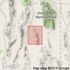
- Areal extent
- AAPG geologic province:
-
- Great Basin province
Summary:
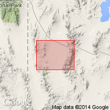
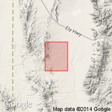
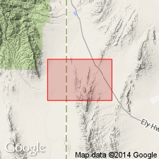
Term Escalante Desert Formation extended into the east and south parts of the mapped area, White Pine Co, NV, Great Basin province. Andesite lava flow member is the only member present; it lies unconformably above the formation of the Gouge Eye and unconformably below the Cottonwood Wash Tuff. Of Oligocene age.
Source: GNU records (USGS DDS-6; Denver GNULEX).
For more information, please contact Nancy Stamm, Geologic Names Committee Secretary.
Asterisk (*) indicates published by U.S. Geological Survey authors.
"No current usage" (†) implies that a name has been abandoned or has fallen into disuse. Former usage and, if known, replacement name given in parentheses ( ).
Slash (/) indicates name conflicts with nomenclatural guidelines (CSN, 1933; ACSN, 1961, 1970; NACSN, 1983, 2005, 2021). May be explained within brackets ([ ]).