The National Geologic Map Database is migrating to a new infrastructure. We apologize for any service disruptions during this process.
|
|---|


- Usage in publication:
-
- Erwin quartzite*
- Modifications:
-
- Named
- Dominant lithology:
-
- Quartzite
- Sandstone
- AAPG geologic province:
-
- Piedmont-Blue Ridge province
Summary:
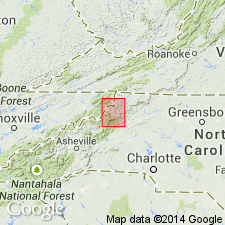
Named the Erwin quartzite in eastern TN, western NC, and southwestern VA for Erwin, Unicoi Co., TN. Consists of white sandstone and quartzite of very uniform appearance. Strata are composed of fine white sand, more or less cemented by secondary silica. Layers are massive and show scarcely any shale partings. Thickness is 500 to 700 feet. Between the quartzite and overlying Shady limestone are a few feet of sandy shale and thin sandstone containing a few OLENELLUS fossils; SCOLITHUS [SKOLITHOS] borings are common in the quartzites. Overlies the Hampton shale and underlies the Shady limestone. The Erwin is of Early Cambrian age.
Source: GNU records (USGS DDS-6; Reston GNULEX).
For more information, please contact Nancy Stamm, Geologic Names Committee Secretary.
Asterisk (*) indicates published by U.S. Geological Survey authors.
"No current usage" (†) implies that a name has been abandoned or has fallen into disuse. Former usage and, if known, replacement name given in parentheses ( ).
Slash (/) indicates name conflicts with nomenclatural guidelines (CSN, 1933; ACSN, 1961, 1970; NACSN, 1983, 2005, 2021). May be explained within brackets ([ ]).