The National Geologic Map Database is migrating to a new infrastructure. We apologize for any service disruptions during this process.
|
|---|


- Usage in publication:
-
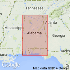
- Erin shale*
- Modifications:
-
- Named
- Dominant lithology:
-
- Slate
- Shale
- AAPG geologic province:
-
- Appalachian basin
Summary:
Erin shale named. Described as black carbonaceous shale or slate exposed in vicinity of Erin, Clay Co., eastern AL. Weathers gray or dirty white. Thickness tentatively estimated as 2,000 ft. Contains fossil plants of Carboniferous (probably Pennsylvanian) age. Heretofore included in Talladega slate.
Source: GNU records (USGS DDS-6; Reston GNULEX).
- Usage in publication:
-
- Erin Slate Member*
- Modifications:
-
- Overview
- AAPG geologic province:
-
- Appalachian basin
Summary:
Author follows usage of Cook (1982) who uses the name as Erin Slate Member of Lay Dam Formation. Carboniferous lycopods reported by Smith (1903) have been re-examined and their ages confirmed; attempts to recollect the fossils have been unsuccessful (Gastaldo and Cook, 1982). Erin is thinly foliated, variably carbonaceous phyllite with dominant slaty cleavage (Gastaldo and Cook, 1982). Cook (1982) shows Erin almost entirely separated from rest of Lay Dam Formation by thrust fault. Author questions whether or not stratigraphic order may be reversed and whether metamorphism therefore is Alleghanian rather than Acadian.
Source: GNU records (USGS DDS-6; Reston GNULEX).
For more information, please contact Nancy Stamm, Geologic Names Committee Secretary.
Asterisk (*) indicates published by U.S. Geological Survey authors.
"No current usage" (†) implies that a name has been abandoned or has fallen into disuse. Former usage and, if known, replacement name given in parentheses ( ).
Slash (/) indicates name conflicts with nomenclatural guidelines (CSN, 1933; ACSN, 1961, 1970; NACSN, 1983, 2005, 2021). May be explained within brackets ([ ]).