


- Usage in publication:
-
- Equality Formation
- Modifications:
-
- Original reference
- Dominant lithology:
-
- Clay
- Silt
- Sand
- Gravel
- AAPG geologic province:
-
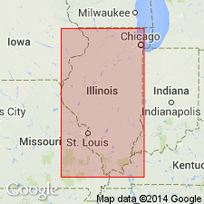
- Illinois basin
Summary:
Pg. 72-75; Illinois Bull., no. 95, p. 226-227, 1975. Equality Formation. Lacustrine silt, clay, sand, and locally gravel. Thickness up to 52 feet in type region; may exceed 100 feet in subsurface. Divided into: (1) Carmi Member, relatively deep-water sediments (mostly silt and clay), commonly 20 to 40 feet thick; and (2) Dolton Member, near-shore sediments (mostly sand), 8 feet thick. At type section underlies Peoria Loess. Fossiliferous. Age is Pleistocene (Wisconsinan Age; Altonian and Woodfordian Subages).
Type section [no longer exposed, ca. 1996 (see Hansel and Johnson, 1996)]: Saline River section, excavation at bridge crossing Saline River, 4 mi (6.4 km) southwest of Equality, in southeast corner of SW/4 sec. 27, T. 9 S., R. 7 E., Gallatin Co., southeastern IL. Named from village of Equality, Gallatin Co., southeastern IL.
Source: Publication; Hdbk Illinois stratigraphy (Illinois Geol. Survey Bull. 95, p. 226-227); US geologic names lexicon (USGS Bull. 1520, p. 97).

- Usage in publication:
-
- Equality Formation
- Modifications:
-
- Overview
- AAPG geologic province:
-
- Illinois basin
Summary:
Equality Formation in the study area is mostly a gray, dark gray, greenish gray, or dark greenish gray silt loam, but it may have silty clay loam, sandy loam, or loam textures. Unit was subdivided by Heinrich (1982) into two informal members--the Altonian Cottage member and the Woodfordian Texas City member. Deposits in the present study area probably correlate with the Texas City member. According to classification of Willman and Frye (1970), deposits correlate with the Carmi Member. Underlies Cahokia Formation. Overlies Oak formation (new, informal).
Source: GNU records (USGS DDS-6; Reston GNULEX).
- Usage in publication:
-
- Equality Formation*
- Modifications:
-
- Principal reference
- Revised
- AAPG geologic province:
-
- Illinois basin
- Michigan basin
- Wisconsin arch
Summary:
Pg. 6 (fig. 2), 16-18, 60-64, 75, 98-100, 103+. Equality Formation of Mason Group. A discontinuous and patchy unit recognized in outcrop and subsurface of central and northern Illinois. Divided into: (1) the Lake Michigan Member, gray, fine-grained, laminated sediments above the Chippewa unconformity [=upper Lake Michigan Formation of Foster and Coleman, 1992, USGS I-map 2202]; (2) red, fine-grained laminated sediments, = lower Lake Michigan Formation of Foster and Coleman (1992); and (3) the Peddicord Tongue, =the stratified silt and clay extending beneath the Tiskilwa and previously included in Willman and others' Peddicord Formation and Ford's Ashmore Member of Wedron Formation. The coarser grained (mostly sand and gravel) stratified sediments are transferred to the Henry Formation of Mason Group (see Dolton facies). Thickness <6.6 to 164+ feet (2 to 50+ m). Occurs above Sangamon Geosol. Intertongues with other formations of Mason Group, notably Henry Formation, and diamicton units of Wedron Group. Correlates with part of Atherton and Martinsville Formations of Indiana. Age is Pleistocene (Wisconsinan Age; Woodfordian Subage), based on radiocarbon dating.
Principal reference sections:
(1) Charleston section, in south wall of Charleston stone quarry, approx. 500 ft (152 m) west of Embarrass River and 100 ft (30 m) north of RR tracks, in SW/4 NW/4 sec. 5, T. 12 N., R. 10 E., Ashmore 7.5-min quadrangle, Coles Co., east-central IL;
(2) Core 9V, Lake Michigan, Lat. 42 deg. 23.8 min. N., Long. 87 deg. 33.2 min. W., about 12.5 mi (20 km) east of Waukegan, IL;
(3) Wedron section, in highwalls of pits in Wedron Silica Company quarries, in secs. 8, 9, 10, and 16, T. 34 N., R. 4 E., Wedron 7.5-min quadrangle, La Salle Co., IL.
Source: Publication.
For more information, please contact Nancy Stamm, Geologic Names Committee Secretary.
Asterisk (*) indicates published by U.S. Geological Survey authors.
"No current usage" (†) implies that a name has been abandoned or has fallen into disuse. Former usage and, if known, replacement name given in parentheses ( ).
Slash (/) indicates name conflicts with nomenclatural guidelines (CSN, 1933; ACSN, 1961, 1970; NACSN, 1983, 2005, 2021). May be explained within brackets ([ ]).