The National Geologic Map Database is migrating to a new infrastructure. We apologize for any service disruptions during this process.
|
|---|


- Usage in publication:
-
- Ephraim conglomerate*
- Modifications:
-
- Named
- Dominant lithology:
-
- Conglomerate
- AAPG geologic province:
-
- Wasatch uplift
Summary:
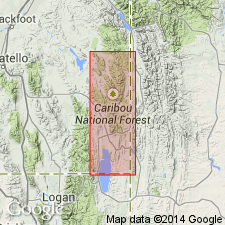
Named as the basal formation of Gannett group for exposures in Ephraim Valley, sec 36, T10S, R45E, Caribou Co, ID on the Wasatch uplift. No type locality designated. Is a red conglomerate with minor amounts of sandstone and thin bands of gray to purplish limestone. Is about 1,000 ft thick at type locality [in Ephraim Valley]. Pebbles composed of a variety of materials. Overlies Stump sandstone (new); underlies Peterson limestone (new) of Gannett group. Is of Cretaceous? age.
Source: GNU records (USGS DDS-6; Denver GNULEX).
- Usage in publication:
-
- Ephraim Conglomerate
- Modifications:
-
- Overview
- Areal extent
- AAPG geologic province:
-
- Green River basin
- Wasatch uplift
- Snake River basin
Summary:
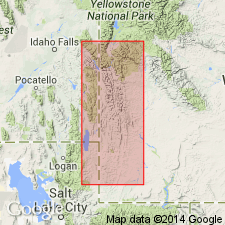
Basal formation (of 5) of Gannett Group. Type section at Red Mountain, Ephraim Valley, Caribou Co, ID, Wasatch uplift where about 1,025 ft thick. Isopach map; thickens westward from central Lincoln and Uinta Cos, WY to more than 1,100 ft in central western Lincoln Co (Greater Green River basin) and adjoining parts of ID (Snake River basin and Wasatch uplift). Consists mostly of conglomerate but also has sandstone, red mudstone, calcareous-nodule beds at type. Conglomerate has boulders up to 15 in diameter at type where most of cobbles, pebbles are subround to well rounded, red, black, white quartzite and some angular black chert and where cross-bedded, laminated salt-and-pepper sandstone interfingered with conglomerate. North of type, formation has more sandstone than at type and pebbles are up to 2 1/2 in diameter. Northeast of type, pebbles in conglomerate as much as 1/2 in diameter, whereas to east of type cobbles in conglomerate up to 8 in diameter. Southeast of type at Turkey Creek, formation contains no conglomerate. Near Evanston, WY, Stump Formation (J)-Ephraim contact not possible to choose. Section 1,186.5 ft thick measured and described in NW1/4, T29N, R118W, Lincoln Co, WY. Underlies Peterson Limestone at Gannett. Cross sections. Saurian bones, gastroliths, charophytes, belemnites, etc. An orogenic deposit illustrating change from marine (J) to nonmarine (K). Neocomian and Aptian, Early Cretaceous age.
Source: GNU records (USGS DDS-6; Denver GNULEX).
For more information, please contact Nancy Stamm, Geologic Names Committee Secretary.
Asterisk (*) indicates published by U.S. Geological Survey authors.
"No current usage" (†) implies that a name has been abandoned or has fallen into disuse. Former usage and, if known, replacement name given in parentheses ( ).
Slash (/) indicates name conflicts with nomenclatural guidelines (CSN, 1933; ACSN, 1961, 1970; NACSN, 1983, 2005, 2021). May be explained within brackets ([ ]).