The National Geologic Map Database is migrating to a new infrastructure. We apologize for any service disruptions during this process.
|
|---|


- Usage in publication:
-
- Enterprise sandstone
- Modifications:
-
- Original reference
- Dominant lithology:
-
- Sandstone
- AAPG geologic province:
-
- Chautauqua platform
Summary:
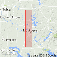
Enterprise sandstone. The Salt sand of Okmulgee underground is to be correlated with the massive sandstone 300 feet above base of the Boggy in Rattlesnake Mountain, just northwest of Warner [Muskogee County]. This has been called Enterprise sandstone (a manuscript name), from a locality on north side of McAlester basin. [The town of Enterprise is in Haskell County.]
Source: US geologic names lexicon (USGS Bull. 896, p. 692).

- Usage in publication:
-
- Enterprise sandstone†
- Modifications:
-
- Abandoned
- AAPG geologic province:
-
- Chautauqua platform
Summary:
†Enterprise sandstone in Boggy shale. This name being preoccupied in several senses, and the sandstone having been found, by tracing, to be same as Bluejacket sandstone, it was called Bluejacket by C.W. Wilson, Jr., in 1935 (AAPG Bull., v. 19, no. 4, p. 504-520). Wilson treated the Bluejacket as top member of Savanna sandstone, but it is now treated by the USGS as basal member of Boggy shale, and Enterprise sandstone has been discarded. (See C.H. Dane and T.A. Hendricks, AAPG Bull., v. 20, no. 3, 1936, p. 312-314.)
Source: US geologic names lexicon (USGS Bull. 896, p. 691).
- Usage in publication:
-
- Enterprise sandstone†
- Modifications:
-
- Abandoned
- AAPG geologic province:
-
- Chautauqua platform
Branson, C.C., 1957, Rejected Oklahoma stratigraphic names: Oklahoma Geology Notes, v. 17, no. 11, p. 106-108.
Summary:
Pg. 107. †Enterprise sandstone. Abandoned by Oklahoma Geol. Survey. Name of the Haskell County village was given to unit now known as Bluejacket sandstone. Name preoccupied.
Source: US geologic names lexicon (USGS Bull. 1200, p. 1268).
For more information, please contact Nancy Stamm, Geologic Names Committee Secretary.
Asterisk (*) indicates published by U.S. Geological Survey authors.
"No current usage" (†) implies that a name has been abandoned or has fallen into disuse. Former usage and, if known, replacement name given in parentheses ( ).
Slash (/) indicates name conflicts with nomenclatural guidelines (CSN, 1933; ACSN, 1961, 1970; NACSN, 1983, 2005, 2021). May be explained within brackets ([ ]).