The National Geologic Map Database is migrating to a new infrastructure. We apologize for any service disruptions during this process.
|
|---|


- Usage in publication:
-
- Ensenada formation
- Modifications:
-
- Overview
- Revised
- Dominant lithology:
-
- Shale
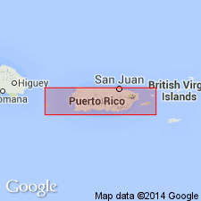
- AAPG geologic province:
-
- Caribbean region
Summary:
In Yauco area, the younger complex, more than 9,000 m thick, has been divided into eight formations: Sabana Grande, El Rayo, Ensenada, Rio Yauco, Rio Loco, Rio Blanco, San German, and Jicara. Ensenada is considered to have been deposited in a southern basin penecontemporaneously with deposition of Rio Yauco and Rio Blanco formations in a northern basin. Ensenada and Rio Yauco formations overlie Sabana Grande and El Rayo formations unconformably and are separated from overlying San German and Jicara formations, at least locally, by unconformities. Age is Late Cretaceous.
Source: GNU records (USGS DDS-6; Reston GNULEX).
For more information, please contact Nancy Stamm, Geologic Names Committee Secretary.
Asterisk (*) indicates published by U.S. Geological Survey authors.
"No current usage" (†) implies that a name has been abandoned or has fallen into disuse. Former usage and, if known, replacement name given in parentheses ( ).
Slash (/) indicates name conflicts with nomenclatural guidelines (CSN, 1933; ACSN, 1961, 1970; NACSN, 1983, 2005, 2021). May be explained within brackets ([ ]).