The National Geologic Map Database is migrating to a new infrastructure. We apologize for any service disruptions during this process.
|
|---|


- Usage in publication:
-
- Enid formation*
- Modifications:
-
- Original reference
- Dominant lithology:
-
- Shale
- Sandstone
- AAPG geologic province:
-
- Anadarko basin
- Chautauqua platform
- Sedgwick basin
Summary:
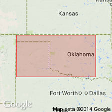
Pg. 39-44, map. Enid formation includes all red beds from base of Permian to lowermost gypsum ledge on east slope of Gypsum Hills. Top of formation is not a plane, since the gypsum beds which mark its uppermost limits are more or less lenticular when traced along distances. Is chiefly brick-red clay shales, with some interbedded ledges of red and whitish sandstone. Thickness 1,200 to 1,500 feet. Includes Harper, Salt Plain, Cedar Hills, and greater part of Flower-pot member of Cragin's first paper and Kingfisher and Glass Mountain formations of his second paper. Underlies Blaine formation and overlies Wellington formation. Age is Permian.
Named from Enid, Garfield Co., western OK. Also recognized in south-central KS.
Source: US geologic names lexicon (USGS Bull. 896, p. 690); supplemental information from GNU records (USGS DDS-6; Denver GNULEX).
- Usage in publication:
-
- Enid formation
- Modifications:
-
- Areal extent
- AAPG geologic province:
-
- Anadarko basin
- Chautauqua platform
- South Oklahoma folded belt(?)
Summary:
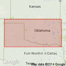
Pg. 24. Enid formation. It can readily be seen that Enid formation is a color distinction and not a contant stratigraphic unit. In some places it includes more than in others. It is a name applied to part of lower Permian Red Beds, and does not include the nonred Permian, even though it is of same age as lower part of Enid.
Source: US geologic names lexicon (USGS Bull. 896, p. 690).
- Usage in publication:
-
- Enid formation
- Modifications:
-
- Areal extent
- AAPG geologic province:
-
- South Oklahoma folded belt
- Chautauqua platform
- Anadarko basin
- Palo Duro basin
Summary:
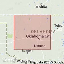
Pg. 88; [AAPG Bull., v. 8, no. 3, p. 322-341, 1924]. Enid formation is exposed in all or parts of Murray, Garvin, Stephens, McClain, Cleveland, Oklahoma, Pottawatomie, Canadian, Logan, Lincoln, Kingfisher, Blaine, Major, Garfield, Noble, Payne, Kay, Grant, Woodward, Alfalfa, Harper, and Woods Counties, western Oklahoma. Recent work in southwestern Oklahoma has led to subdivision of upper part of rocks of that area heretofore mapped as Enid into Chickasha and Duncan formations; also to conclusion that lower part of typical Enid (Enid, Garfield County) is there represented by upper part of rocks mapped as Clear Fork and Wichita formations on 1926 Oklahoma geologic map. Base of Enid is believed by Aurin and Clark to be top of Wellington formation of Kansas. There are several unsolved problems connected with relations to Enid. In southwestern Oklahoma it includes equivalents of Chickasha, Duncan, Clear Fork, and possibly part of Wichita. In Kansas the equivalent formations are Harper, Salt Plains, Cedar Hills, and a part of at least of Flowerpot [Flower-pot] shale. [Age is Permian.]
Source: US geologic names lexicon (USGS Bull. 896, p. 690).
- Usage in publication:
-
- Enid group
- Modifications:
-
- Revised
- AAPG geologic province:
-
- Chautauqua platform
- Anadarko basin
Summary:
Pg. 416-421. Enid group. The Enid formation as originally described included all Oklahoma Permian red beds below base of Blaine gypsum. It has been divided into following formations (descending): Chickasha formation, Duncan sandstone, Hennessey shale, Garber sandstone, Wellington formation, and Stillwater formation.
See also F.L. Aurin and others, 1926, AAPG Bull., v. 10, no. 8, pt. 2, p. 786-799.
Source: US geologic names lexicon (USGS Bull. 896, p. 690); supplemental information from GNU records (USGS DDS-6; Denver GNULEX).

- Usage in publication:
-
- Enid formation*
- Enid group
- Modifications:
-
- Overview
Summary:
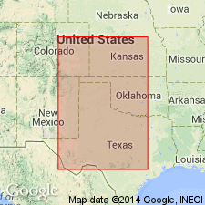
Enid formation (Enid group). The Enid and Double Mountain overlap each other, the Duncan and Chickasha being represented in both. Enid appears to have had little usage in recent years. Age is Permian.
Present in western Oklahoma and Kansas(?), and Panhandle of Texas.
Source: US geologic names lexicon (USGS Bull. 896, p. 690).
- Usage in publication:
-
- Enid formation†
- Enid group†
- Modifications:
-
- Abandoned
Branson, C.C., 1957, Old stratigraphic names made available: Oklahoma Geology Notes, v. 17, no. 11, p. 99-103.
Summary:
Pg. 99. †Enid formation (†Enid group). Listed with names abandoned by Oklahoma Geological Survey.
[Name not used on 1954 Geol. map of Oklahoma.]
Source: US geologic names lexicon (USGS Bull. 1200, p. 1266).
For more information, please contact Nancy Stamm, Geologic Names Committee Secretary.
Asterisk (*) indicates published by U.S. Geological Survey authors.
"No current usage" (†) implies that a name has been abandoned or has fallen into disuse. Former usage and, if known, replacement name given in parentheses ( ).
Slash (/) indicates name conflicts with nomenclatural guidelines (CSN, 1933; ACSN, 1961, 1970; NACSN, 1983, 2005, 2021). May be explained within brackets ([ ]).