The National Geologic Map Database is migrating to a new infrastructure. We apologize for any service disruptions during this process.
|
|---|


- Usage in publication:
-
- Englishtown sand
- Modifications:
-
- Named
- Dominant lithology:
-
- Sand
- AAPG geologic province:
-
- Atlantic Coast basin
Kummel, H.B., 1907, [footnote]: New Jersey Geological Survey Report on Paleontology, v. 4, p. 17.
Summary:
Englishtown sand replaces term Columbus sand as Columbus is preoccupied by Devonian unit in OH. Assigned to Matawan group. Described by Kummel and Knapp (1904) as white or yellow quartz sand marked by delicate lines of red. Thickness 20 to 100 ft. Overlies Woodbury clay and underlies Marshalltown clay marl. Age is Late Cretaceous.
Source: GNU records (USGS DDS-6; Reston GNULEX).
- Usage in publication:
-
- Englishtown Formation*
- Modifications:
-
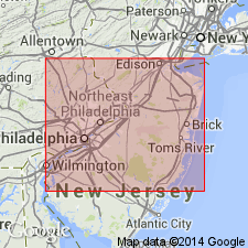
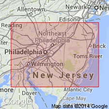
- Areal extent
- AAPG geologic province:
-
- Atlantic Coast basin
Summary:
In northeastern MD and northern DE of northernmost Delmarva Peninsula, the Upper Cretaceous terms Matawan and Monmouth Formations or Groups are not useful, and they should be restricted from the area in favor of other formations geographically extended from NJ. The Matawan Formation of northeastern MD (Kent and Cecil Cos.) is replaced by (ascending) Merchantville, Englishtown, and Marshalltown Formations, and the Monmouth Formation by the Mount Laurel Sand (p. 22 and fig. 4). The ascending Woodbury Clay, Wenonah, and Navesink Formations pinch out in NJ and are not present in DE and MD. [Although not stated in this report, Matawan Formation is now recognized on the western shore and eastern shore of southern MD where the Merchantville, Englishtown, and Marshalltown cannot be recognized and extended into southern MD (N.F. Sohl, 7/12/84, oral communication).]
Source: GNU records (USGS DDS-6; Reston GNULEX).
- Usage in publication:
-
- Englishtown Formation*
- Modifications:
-
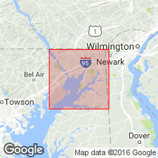
- Areal extent
- Overview
- AAPG geologic province:
-
- Atlantic Coast basin
Summary:
Englishtown Formation no doubt extends across Cecil Co. from near Back Creek to Grove Neck, but is mostly covered and has been seen at only two places: 10.1 ft exposed on Mauldin Mountain and 10 to 15 ft exposed on a high bluff on the north side of the Sassafras River about 1.5 mi east of Grove Point. Unit is also exposed in Kent Co., and it has been recognized in a few drillholes in MD. In DE, unit is present along Chesapeake and Delaware Canal, 1.25 mi east of the Summit Bridge according to Owens and others, (1970). Unit is well-stratified, silty, fine to very fine sand that is micaceous and in some places slightly glauconitic. Lignite fragments are common. Locally contains some layers of black, unctuous clay. [This manuscript was reviewed by the GNU in 1973, but was not published until 1990. Field work for this study was done in the late 1960's. The Englishtown is assigned to the Matawan Group in this report, but this does not reflect current USGS usage.]
Source: GNU records (USGS DDS-6; Reston GNULEX).
- Usage in publication:
-
- Englishtown Formation
- Modifications:
-
- Overview
- AAPG geologic province:
-
- Atlantic Coast basin
Summary:
Englishtown Formation of Matawan Group was originally called the Hazlet sand, then the Columbus Bed by Salisbury (1898). According to Richards (1956), "The Englishtown is a conspicuous bed of white or yellow quartz sand that is slightly micaceous and glauconitic. Some beds are locally cemented by iron oxide to form rather massive deposits of sandstone. There are a few lenses of clay or clayey sand, especially in the upper part of the formation, but these are probably not continuous. Cross-bedding is characteristic of some phases of the Englishtown." Owens and Sohl (1969) subdivided the Englishtown into three lithofacies: 1) cross-bedded sand in the north; 2) intercalated sand and dark carbonaceous clay in the central part; and 3) massive dark-colored silty fine sand to the southwest. Thickness varies from 42 m in the northeast to 6 to 12 m in the southwest. Fossils for the most part are found only in deep well sections, though some have been reported in outcrop. Unit extends from the Raritan Bay on the northeast to the eastern shore of Chesapeake Bay in the southwest. Best exposures are at the type locality in Monmouth Co., in the Rancocas Woods State Park, Burlington Co., and in the Deep Cut section of the Chesapeake and Delaware Canal. Overlies the Woodbury Formation and underlies the Marshalltown. Age is early late Campanian or late early Campanian.
Source: GNU records (USGS DDS-6; Reston GNULEX).
For more information, please contact Nancy Stamm, Geologic Names Committee Secretary.
Asterisk (*) indicates published by U.S. Geological Survey authors.
"No current usage" (†) implies that a name has been abandoned or has fallen into disuse. Former usage and, if known, replacement name given in parentheses ( ).
Slash (/) indicates name conflicts with nomenclatural guidelines (CSN, 1933; ACSN, 1961, 1970; NACSN, 1983, 2005, 2021). May be explained within brackets ([ ]).