- Usage in publication:
-
- Englevale channel sandstone
- Modifications:
-
- Original reference
- Dominant lithology:
-
- Sandstone
- AAPG geologic province:
-
- Cherokee basin
Summary:
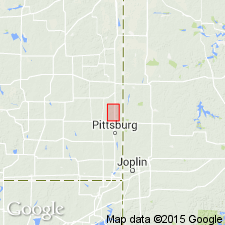
Pg. 1061-1064. Englevale channel sandstone. Usually light-brown with reddish-brown specks, micaceous, somewhat massive and cross-bedded. Locally middle part may be darker and lower part slightly shaly. Thickness 0 to 50 feet. Areal distribution is linear, trending north-northwest from Arma for 9 miles, to Crawford County line, the limit of field work. Is younger than Fort Scott limestone, which it cuts, and may possibly be younger than lower part of Labette shale. So far as seen its upper limit is gradational into lower part of Labette shale, and its base cuts into Fort Scott limestone and in places rests on upper part of Cherokee shale. Age is Pennsylvanian.
Best exposed in vicinity of Englevale, Crawford Co., southeastern KS, along north-south road on east side of town and along east-west road 0.5 mi north of town.
Source: US geologic names lexicon (USGS Bull. 896, p. 689).

- Usage in publication:
-
- Englevale sandstone member
- Modifications:
-
- Revised
Summary:
Pg. 197. Englevale sandstone member of Labette shale is one of several bodies of sandstone, collectively referred to as Warrensburg sandstone. Lies in middle and lower part of Labette shale. Age is Middle Pennsylvanian (Des Moines).
Source: US geologic names lexicon (USGS Bull. 1200, p. 1264-1265).

- Usage in publication:
-
- Englevale sandstone member
- Modifications:
-
- Areal extent
Summary:
Pg. 6. Englevale sandstone member of Labette formation. Geographically extended into southwestern Missouri, Bates County and probably elsewhere. Age is Middle Pennsylvanian (Des Moines).
Source: US geologic names lexicon (USGS Bull. 1200, p. 1264-1265).

- Usage in publication:
-
- Englevale Sandstone Member
- Modifications:
-
- Reference
- AAPG geologic province:
-
- Forest City basin
Summary:
Pg. B195-B196, C9-C15; T.L. Thompson, 2001, Missouri Div. Geol. Land Survey Rpt. Inv., no. 73, p. 96. Englevale Sandstone Member of Labette Shale of Appanoose subgroup [informal] of Marmaton Group. Thickness at reference section 6 feet. Occurs above Alvis coal bed and below Lexington coal bed, both of Labette. Recognized in subsurface of Missouri much more frequently than in exposures. Age is Middle Pennsylvanian (Desmoinesian).
Reference section (subsurface): drill core in S/2 SW/4 SE/4 NE/4 sec. 22, 2000 ft northeast of the waterfall, on east side of Hwy 71 at intersection with old 87th St., Kansas City, Grandview 7.5-min quadrangle, Jackson Co., MO.
Type locality in southeast corner sec. 13, T. 28 S., R. 24 E., Crawford Co., KS.
["Subgroup" not recognized as a formal stratigraphic rank term (CSN, 1933; ACSN, 1961, 1970; NACSN, 1983, 2005, 2021). Considered informal and should not be capitalized.]
Source: Publication.
For more information, please contact Nancy Stamm, Geologic Names Committee Secretary.
Asterisk (*) indicates published by U.S. Geological Survey authors.
"No current usage" (†) implies that a name has been abandoned or has fallen into disuse. Former usage and, if known, replacement name given in parentheses ( ).
Slash (/) indicates name conflicts with nomenclatural guidelines (CSN, 1933; ACSN, 1961, 1970; NACSN, 1983, 2005, 2021). May be explained within brackets ([ ]).

