

- Usage in publication:
-
- Emporia limestone
- Modifications:
-
- Original reference
- Dominant lithology:
-
- Limestone
- AAPG geologic province:
-
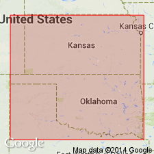
- Forest City basin
Summary:
Pg. 72-85. Emporia limestone. Limestone, quarried at Emporia and to northeast and disappearing under river near Emporia water works. Also present in the road and ravines to the north of Wyckoff. Separated from overlying Americus Limestone by extensive bed of shale and from underlying Wyckoff Limestone by bed of shale 40 to 50 feet thick. Age is Mississippian. Report includes cross section.
Quarried at Emporia, eastern KS. Present in Lyon Co., eastern KS.
Source: US geologic names lexicon (USGS Bull. 896, p. 686-687); supplemental information from GNU records (USGS DDS-6; Denver GNULEX).
- Usage in publication:
-
- Emporia limestone*
- Modifications:
-
- Areal extent
- AAPG geologic province:
-
- Forest City basin
Summary:
Emporia limestone. Mapped in Lyon County, eastern Kansas. Thickness about 10 feet. Overlies Olpe shales and underlies Admire shales. Age is late Carboniferous. Report includes fossil list.
Source: Modified from GNU records (USGS DDS-6; Denver GNULEX).

- Usage in publication:
-
- Emporia limestone*
- Modifications:
-
- Overview
- AAPG geologic province:
-
- Forest City basin
Summary:
Emporia limestone of Wabaunsee group. The definition of Emporia limestone as overlain by Admire shale and underlain by Willard shale was followed by Kansas Geol. Survey and the USGS for many years. Present in eastern Kansas, southeastern Nebraska, northwestern Missouri, and southwestern Iowa. Age is Pennsylvanian.
Source: US geologic names lexicon (USGS Bull. 896, p. 686-687).

- Usage in publication:
-
- Emporia limestone*
- Modifications:
-
- Areal extent
- AAPG geologic province:
-
- Forest City basin
Summary:
Pg. 61-91. Kansas Geol. Survey applies Emporia limestone to beds underlying Admire shale and overlying Willard shale. The Willard shale and so-called Emporia limestone have been difficult to work out. The beds called by these names in Kansas need redefining in order to establish a basis for correlation in Nebraska. I have studied the exposures in vicinity of Wyckoff, Chicago Mound, and Emporia. Emporia, if it is retained, should apply to No. 3 of the Nemaha beds of southeastern Nebraska, because Kirk seems to have meant to apply it to this unit, and because Haworth and Moore have, in effect, defined it as such. This name has priority over Beede's Elmont limestone: this unit (No. 3) underlies Willard shale and overlies Auburn shale, top bed of Humphrey shale member of Wabaunsee formation. [This definition of Emporia limestone was adopted by R.C. Moore in 1932 (Kansas Geol. Soc. 6th Ann. Field Conf. Gdbk., Aug. 28 to Sept. 3) and by Moore and Condra in their Oct. 1932 revised chart of Pennsylvanian rocks of Kansas. In these 1932 reports Admire shale was restricted to uppermost part of Admire shale of previous reports.]
Source: US geologic names lexicon (USGS Bull. 896, p. 686-687); GNC KS-NE Pennsylvanian Corr. Chart, sheet 1, Oct. 1936.

- Usage in publication:
-
- Emporia limestone†
- Modifications:
-
- Abandoned
- AAPG geologic province:
-
- Forest City basin
- Nemaha anticline
Summary:
Pg. 10. Discarded Emporia for Preston. He stated: Preston ("Emporia") limestone formation, 9 to 11 feet thick, underlies Willard shale formation, overlies Auburn shale formation, and includes (descending): Elmont limestone, 2 to 5 feet thick; Harveyville shale, 3 to 7 feet thick; and Reading limestone, 3+ feet thick. Age is Late Pennsylvanian (Virgil).
Source: US geologic names lexicon (USGS Bull. 896, p. 686-687); GNC KS-NE Pennsylvanian Corr. Chart, sheet 2, Oct. 1936.

- Usage in publication:
-
- Emporia limestone†
- Modifications:
-
- Abandoned
- AAPG geologic province:
-
- Forest City basin
- Nemaha anticline
Summary:
Pg. 223. †Emporia limestone. It is impossible to determine to which of 3 or more limestones exposed near Emporia Kirk intended to apply this name. Judging from localities cited by him it appears that he considered as identical beds that are actually 75 feet or more apart. [On p. 226:] It appears from study of type sections that the Elmont limestone = "upper Emporia" of authors. [Moore discarded Emporia limestone from his revised classification as published in this bulletin. See p. 49, where he shows it as replaced by (descending) Elmont limestone, Harveyville shale, and Reading limestone, which he treated as formations.]
[See "Modern classifications of the Pennsylvanian rocks of eastern Kansas and southeastern Nebraska," compiled by M.G. Wilmarth, Secretary of Committee on Geologic Names, USGS unpub. corr. chart, Oct. 1936, sheet 2.]
Source: US geologic names lexicon (USGS Bull. 896, p. 686-687); GNC KS-NE Pennsylvanian Corr. Chart, sheet 2, Oct. 1936.

- Usage in publication:
-
- Emporia limestone*
- Modifications:
-
- Reference
- Revised
- Dominant lithology:
-
- Limestone
- Shale
- Coal
- AAPG geologic province:
-
- Forest City basin
Summary:
Pg. 2274 (fig. 1), 2276. Emporia limestone of Wabaunsee group. As originally defined and now again recognized, the Emporia comprises beds between Willard shale above and Auburn shale below. Thickness ranges from 7 to 40 feet. Includes (ascending) Reading limestone, Harveyville shale, and Elmont limestone members. Kirk (1898) did not define type section or locality; reference section given. Age is Late Pennsylvanian (Virgilian).
Reference section: exposed in roadcut on KS Highway 10, in NW/4 sec. 31, T. 11 S., R. 14 E., Shawnee Co., eastern KS.
Source: US geologic names lexicon (USGS Bull. 1200, p. 1262-1263).
- Usage in publication:
-
- Emporia limestone*
- Modifications:
-
- Areal extent
- AAPG geologic province:
-
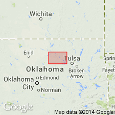
- Chautauqua platform
Summary:
Pg. 55-60. Emporia limestone of Kansas comprises (ascending) Reading limestone, Harveyville shale, and Elmont limestone members. Moore (1949, Kansas Geol. Survey Bull., no. 83) correlated the Reading, Harveyville, and Elmont of Kansas with lower, middle, and upper units of Stonebreaker formation in Osage County, Oklahoma. Name Stonebreaker has been discarded as formation name in north-central Oklahoma in favor of name Emporia. Kansas subdivisions of Emporia are recognizable in Pawnee County; southern extent is not known. Average thickness 90 feet in Pawnee County. Overlies Auburn shale; underlies Gano shale. Age is Late Pennsylvanian (Virgilian).
Source: US geologic names lexicon (USGS Bull. 1200, p. 1262-1263).
For more information, please contact Nancy Stamm, Geologic Names Committee Secretary.
Asterisk (*) indicates published by U.S. Geological Survey authors.
"No current usage" (†) implies that a name has been abandoned or has fallen into disuse. Former usage and, if known, replacement name given in parentheses ( ).
Slash (/) indicates name conflicts with nomenclatural guidelines (CSN, 1933; ACSN, 1961, 1970; NACSN, 1983, 2005, 2021). May be explained within brackets ([ ]).